

HIKING IN THE BÓQUER VALLEY
Route Overview Bóquer valley
This tour takes you into the Bóquer Valley near Port de Pollença. Here you’ll find the route, an interactive map and a GPX track, plus our honest assessment of effort and navigation along the trail through the Vall de Bóquer. This way you can set off relaxed — and you have the GPX as a backup.
Highlights OF THE HIKE IN THE BÓQUERTAL
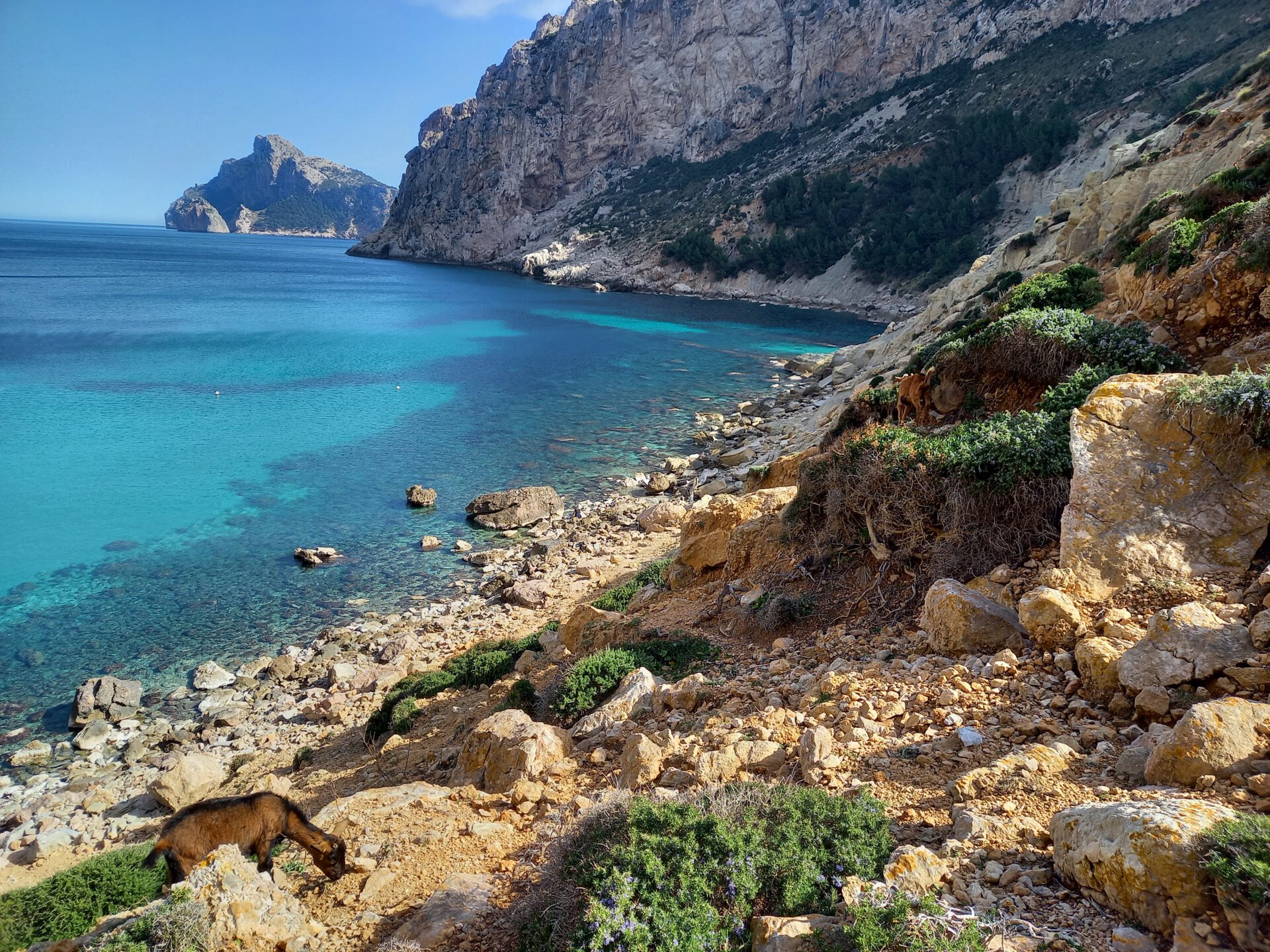
The Bóquer Valley is known for hosting a variety of birds of prey that can be observed on the slopes of the surrounding mountains. So if you’re interested, definitely bring binoculars!
WHAT TO KEEP IN MIND
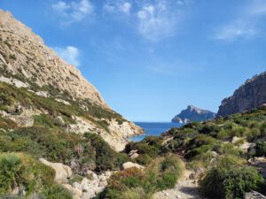
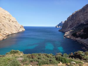
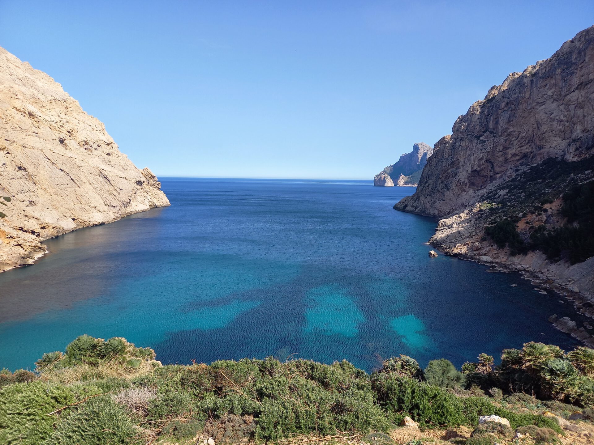
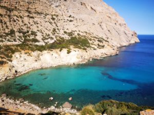
Most of the tour is very easy to walk on well-trodden paths. However, since the route leads over rocky terrain from the bay onwards, we have classified it as moderate. If you don’t want to do this last part, simply enjoy the peace and the view of the bay.
starting point
Hiking parking area on the bypass road of Port de Pollença (parking coordinates: 39.913084, 3.084266).
Want more hikes like this?
Then take a look at our overview of all hikes on Mallorca! This tour is part of the coastal hikes and bays on Mallorca.
This route was also featured in our Best of Mallorca guide to Tramuntana hikes.
-
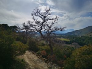
- Boquertal 1

-
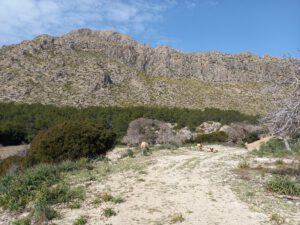

- Bockertal 2
-

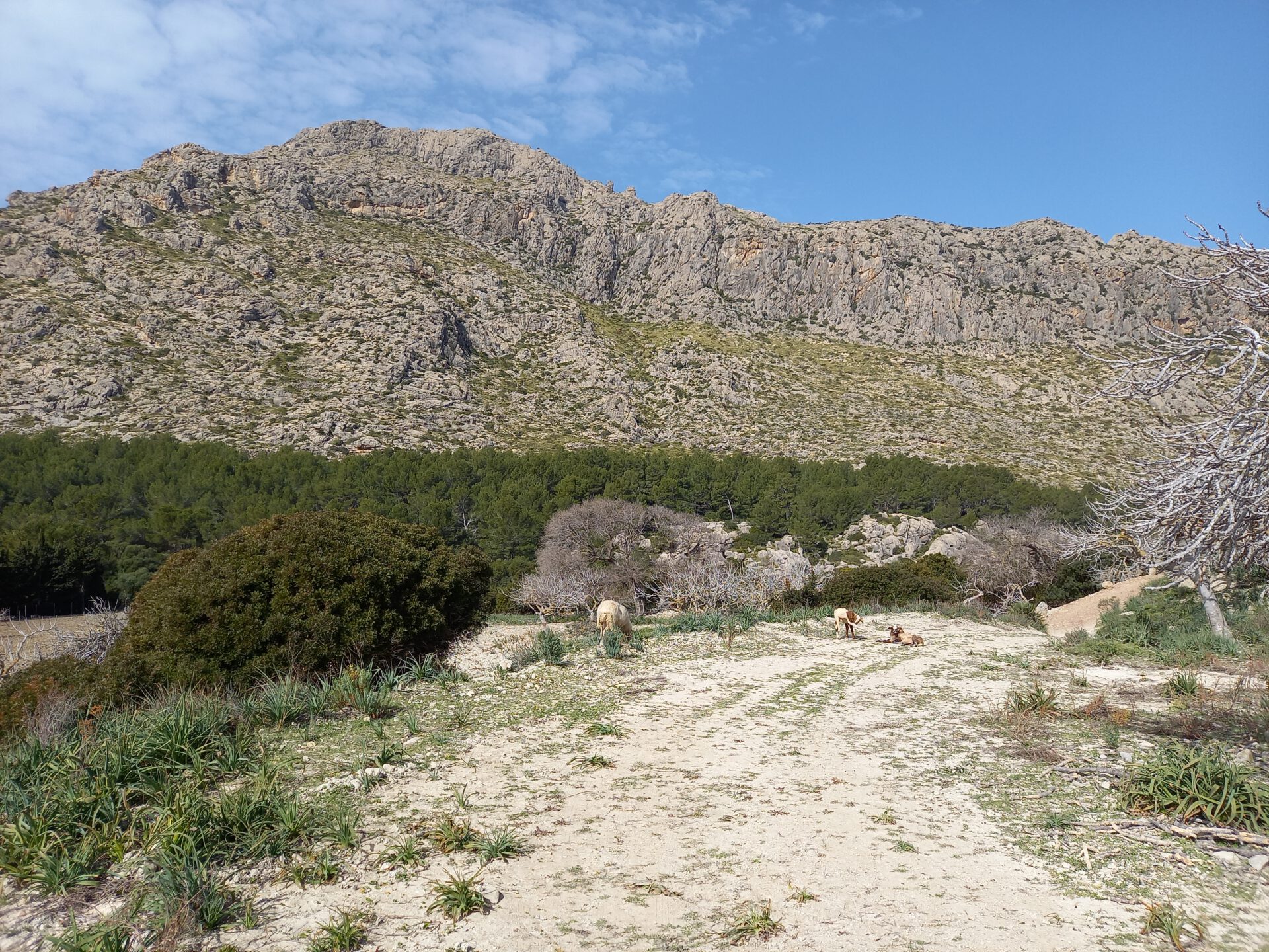
- Boquertal 3
-
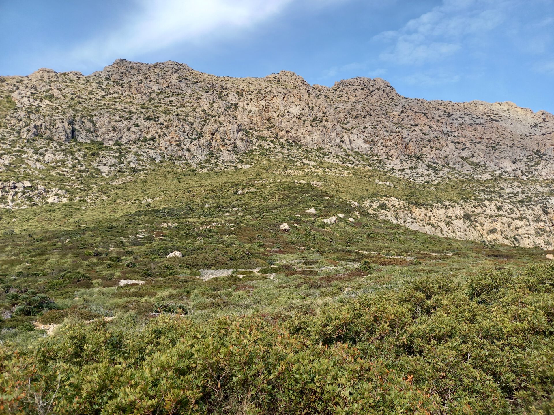
- Boquertal 4

-
- Bockertal 5
-
- Boquertal 6
-
- Boquertal 7

-
- Boquertal 8

FREQUENTLY ASKED QUESTIONS ABOUT THE HIKE THROUGH THE BÓQUER VALLEY
The route follows well-trodden paths as far as the bay and is therefore easy for the most part. From the bay onwards, the hike continues over rocky terrain up to the cliff viewpoint at Punta de la Troneta, which is why we have rated it as moderate.
A large part of the route runs on wide paths with little ascent. In the middle section there are narrower trails and short rocky passages, but overall the hike remains technically easy. The section from the bay to Punta de la Troneta, however, involves scrambling over rocks.
The route is largely exposed to the sun — especially around midday. Starting early and having adequate sun protection are important.
Not directly on the route. Port de Pollença, however, offers many restaurants and cafés — ideally after the hike.
Hardly. The landscape is flat and easy to see, so the paths are mostly easy to recognize. To protect nature and to respect the birds’ retreat areas, we recommend additionally using our interactive 2D map for orientation.
Hardly. The landscape is flat and easy to see, so the paths are mostly easy to recognize. To protect nature and to respect the birds’ retreat areas, we recommend additionally using our interactive 2D map for orientation.
No. The route is publicly accessible; the easy section as far as the bay is visited frequently.
Yes — the route is manageable also for older children, as long as they are sure-footed. In particular, the animals and the proximity to the sea make it exciting for kids. With smaller children, however, you should skip the last part of the route across the rocks.
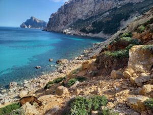
Yes, you can descend to the bay. The path is a bit rocky, but manageable. Swimming is possible — the coast is rocky, but the water is crystal clear.
Yes — the valley is very popular with birdwatchers. With a bit of luck you can spot birds of prey such as Egyptian vultures, short-toed eagles, or red kites. Binoculars are worth bringing.
Weather on THE HIKE THROUGH THE BÓQUER VALLEY
We provide a 24-hour forecast for planning your Boquer valley hike — including temperature, rain, sunshine, cloud cover, plus wind speed and wind direction, for both the start point and the destination.
Check the Weathermap FAQ for more details about the weather data!
Who’s behind Mallorca-Touren? Learn more here!
Have you done this hike and have additional notes? Send us a message!
Questions about the hikes, the maps, or what we offer? Find answers here!
We provide our hiking maps with a lot of care and genuine joy. If you truly like what we’re building here, we’d be very grateful for a donation!