

Torrent de Pareis hike
Route Overview Torrent de Pareis
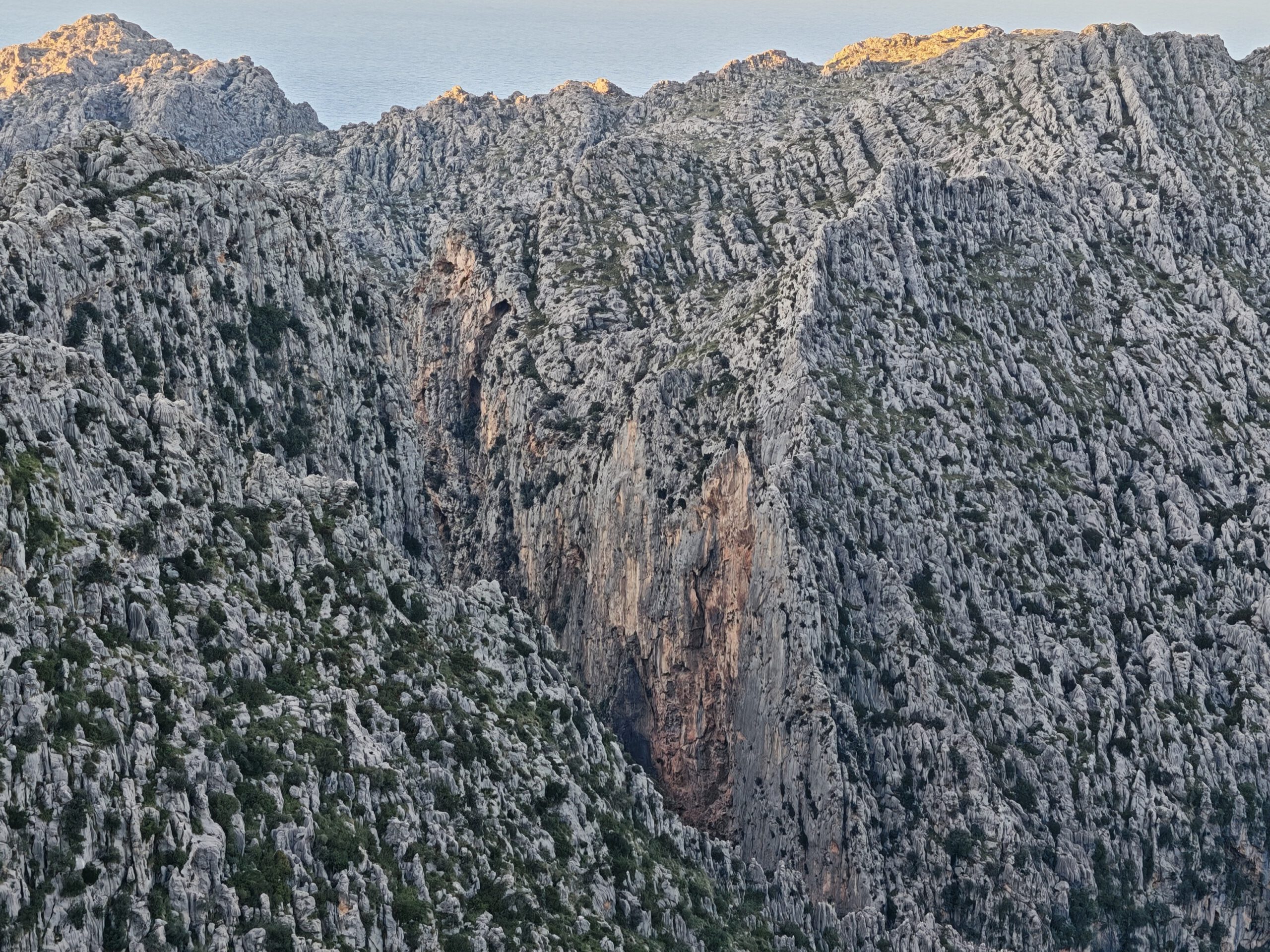
The Torrent de Pareis—also known to many as Sa Fosca—offers spectacular scenery, but in our view, it cannot be considered a “normal” hike under current conditions. This page is therefore not a traditional hiking recommendation, but rather an honest guide featuring a map and an assessment of the many uncertainties along the route.
What to keep in mind
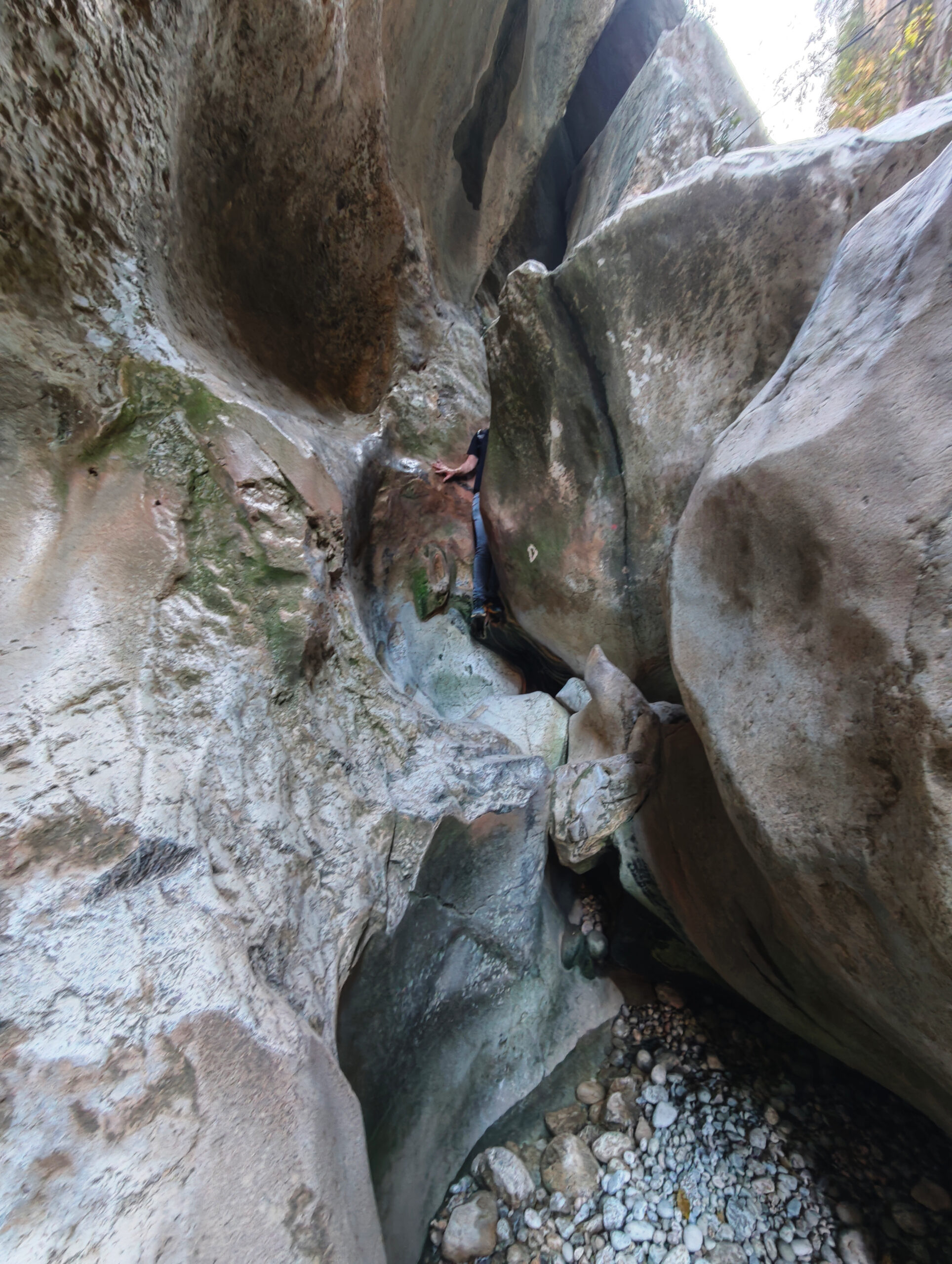
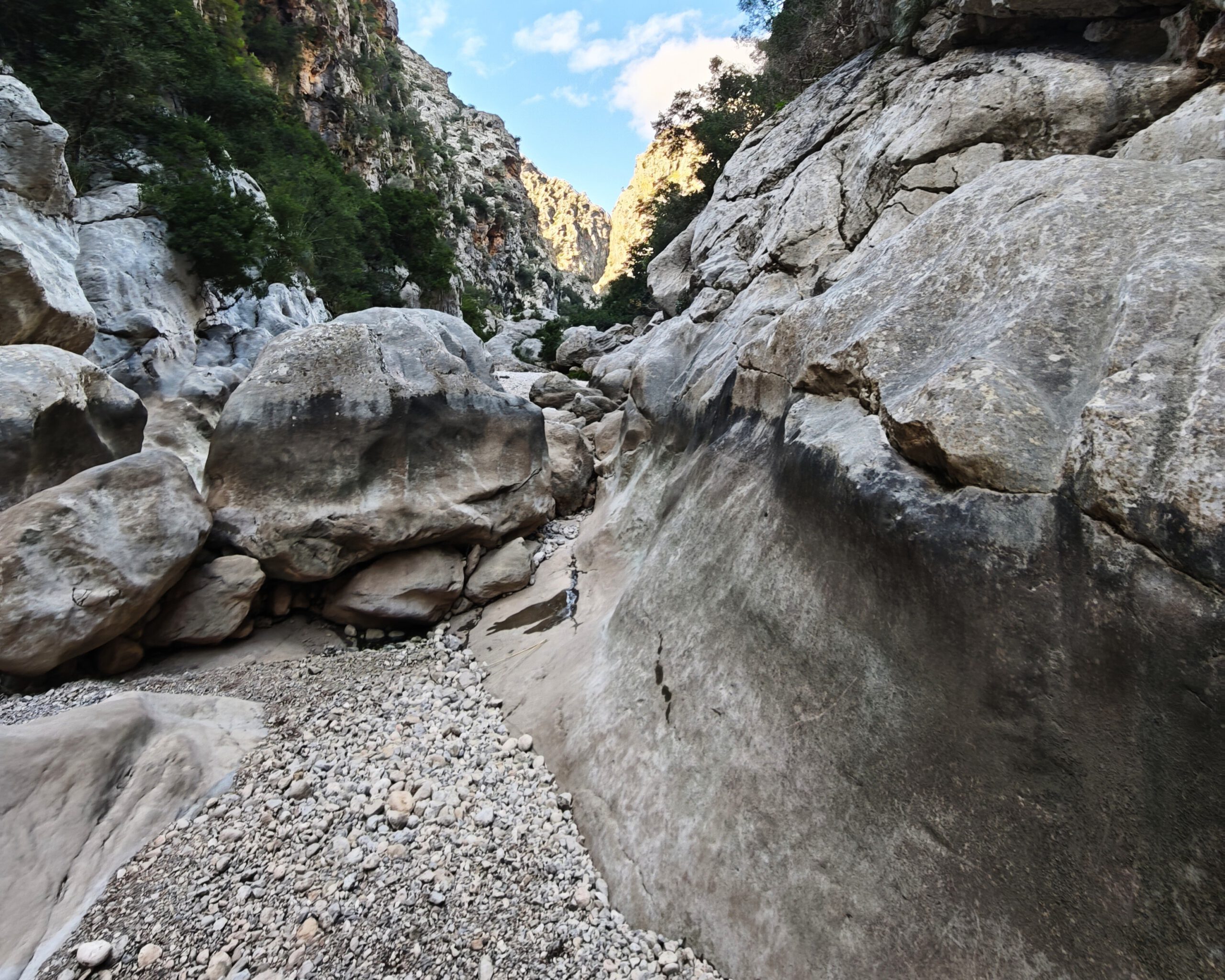
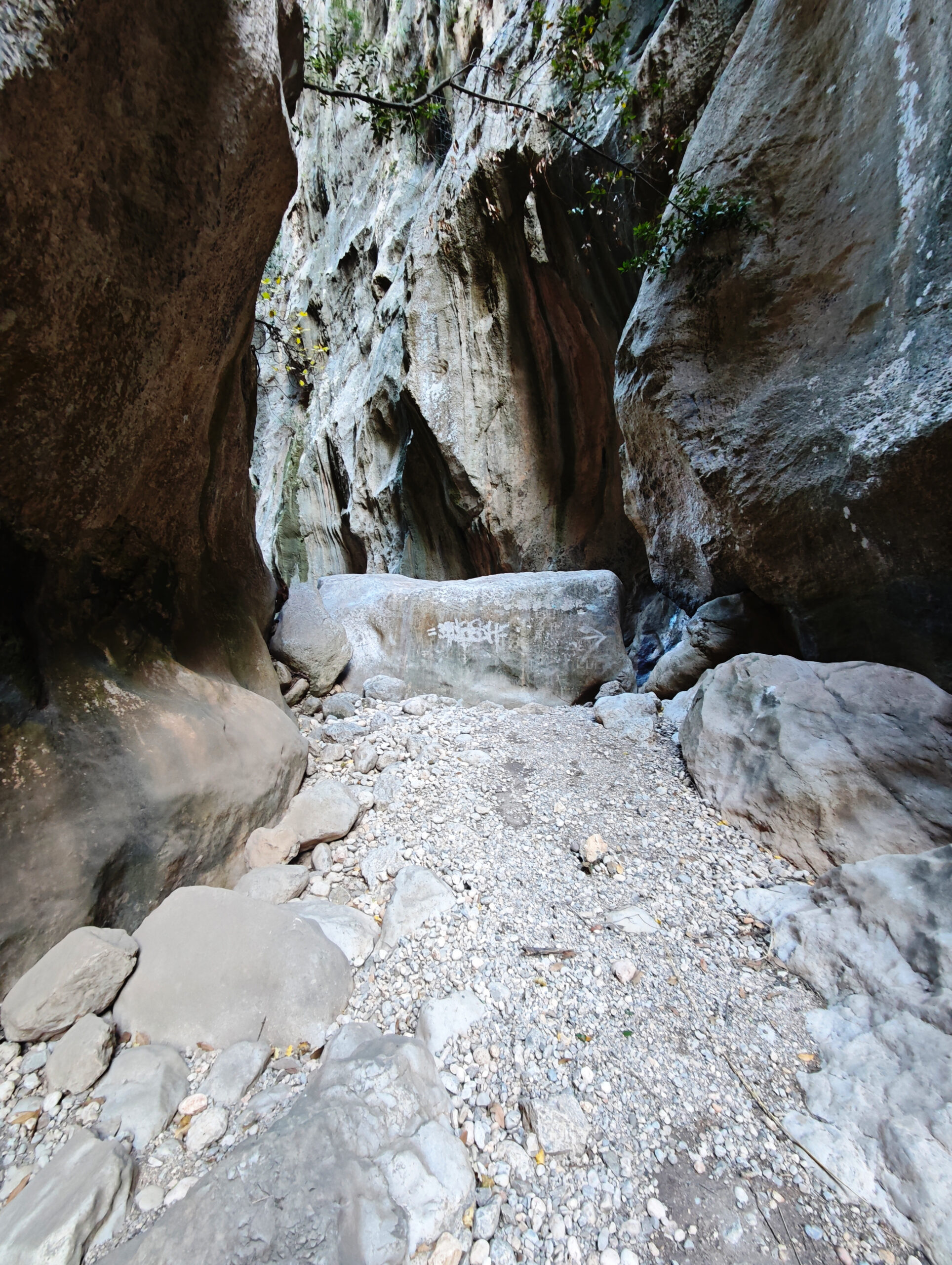
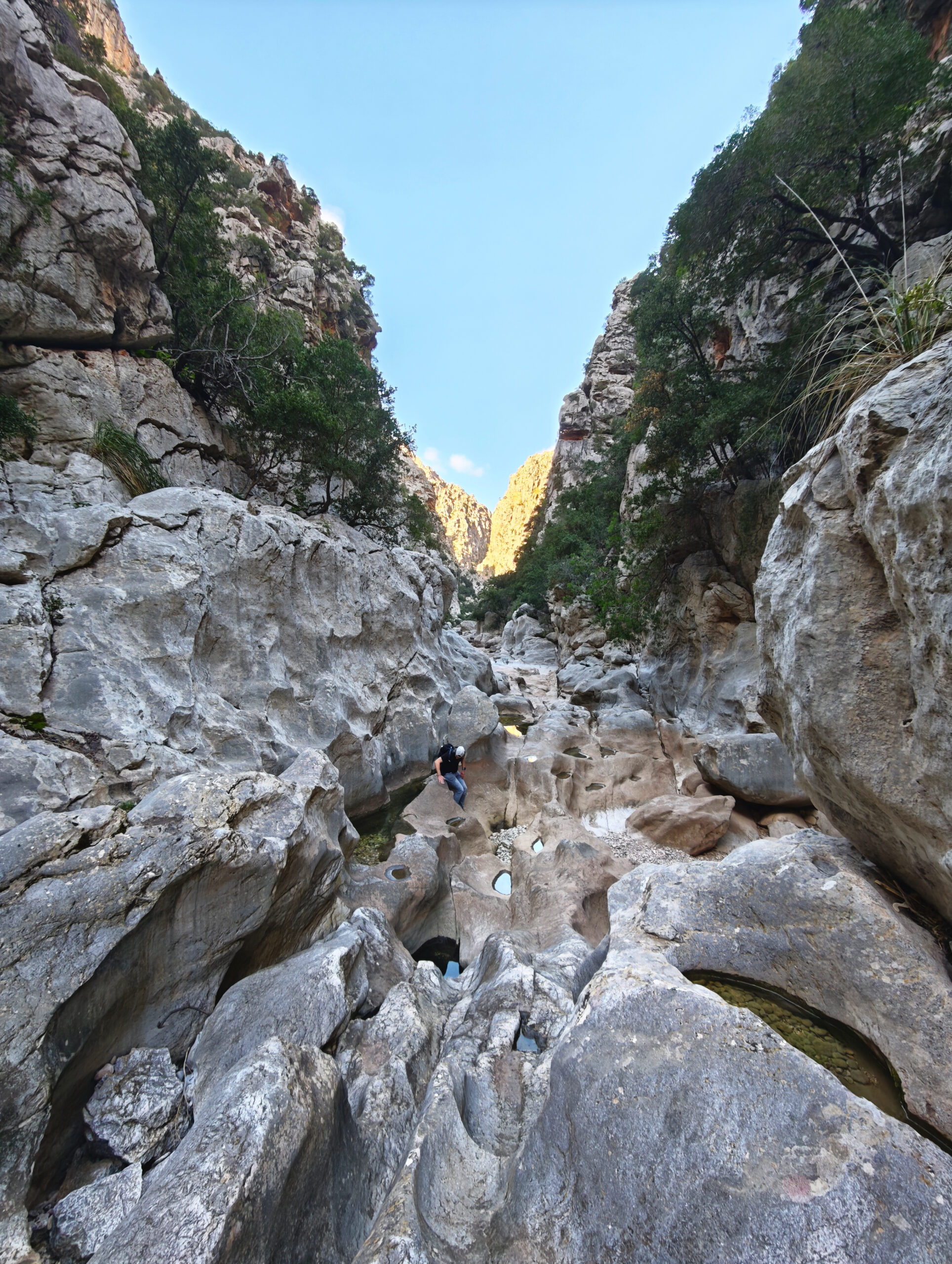
In our view, under current conditions, the Torrent de Pareis is not suitable for hikers without explicit climbing experience. In general, the gorge must be traversed with the utmost caution. In many places, there is a risk of falling several meters; often, within the complex tangle of rocks, there is only a single passable route, which, however, is not clearly marked at practically any point along the way. Even the stone pyramids typical of Mallorca are generally absent. This means that in many places you have to turn back because the path you’ve taken ends at an insurmountable precipice. Here, you must exercise patience to avoid making mistakes.
Furthermore, safety chains that once existed at critical points are no longer present, making these sections significantly more dangerous to traverse! This makes the ascent of the gorge significantly more difficult than the descent.
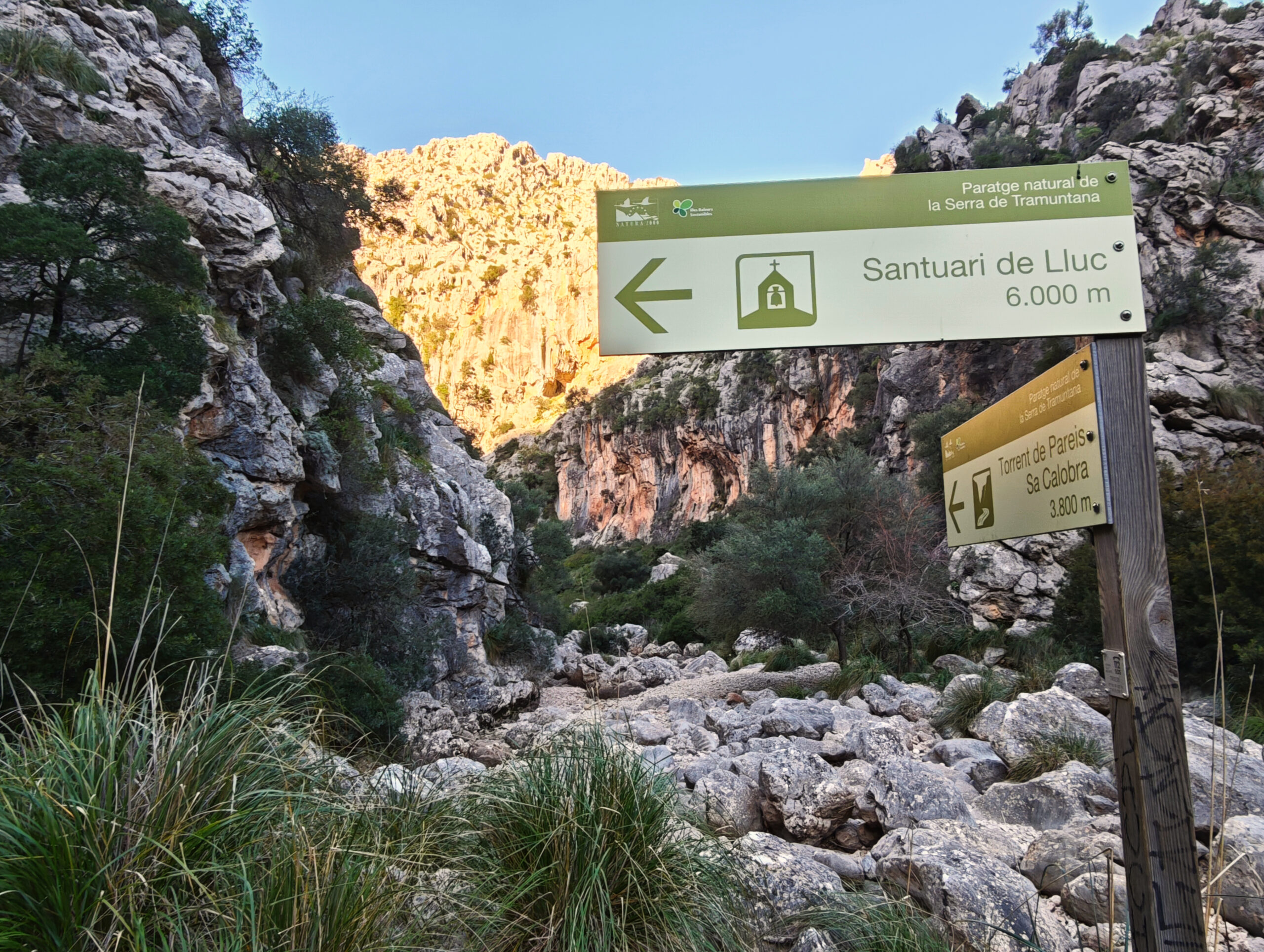
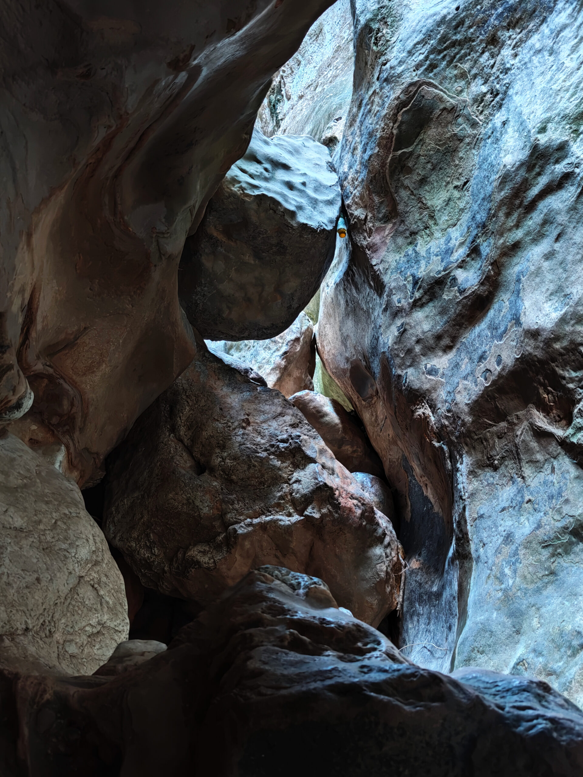
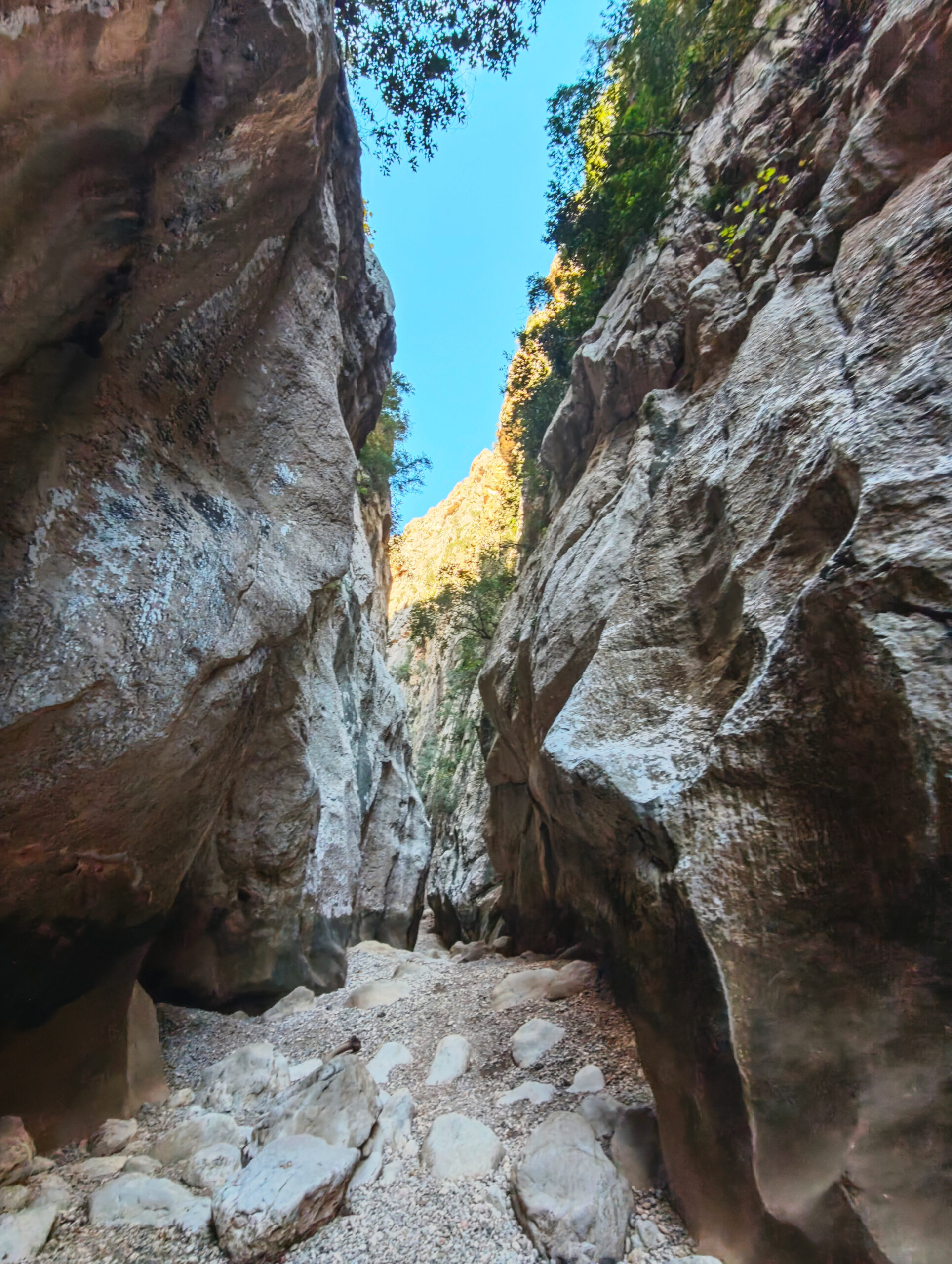
Furthermore, GPX data is only of limited help in the gorge. In some places, the passage is only about 10 meters wide, while the gorge walls rise vertically up to 50 meters high. Under these conditions, you cannot count on clear positioning. Even with good satellite reception, the spatial resolution of the positioning is not high enough in many places to distinguish between passable paths and dead ends. Therefore, we do not provide a track for the gorge itself, but only for the access to the gorge!
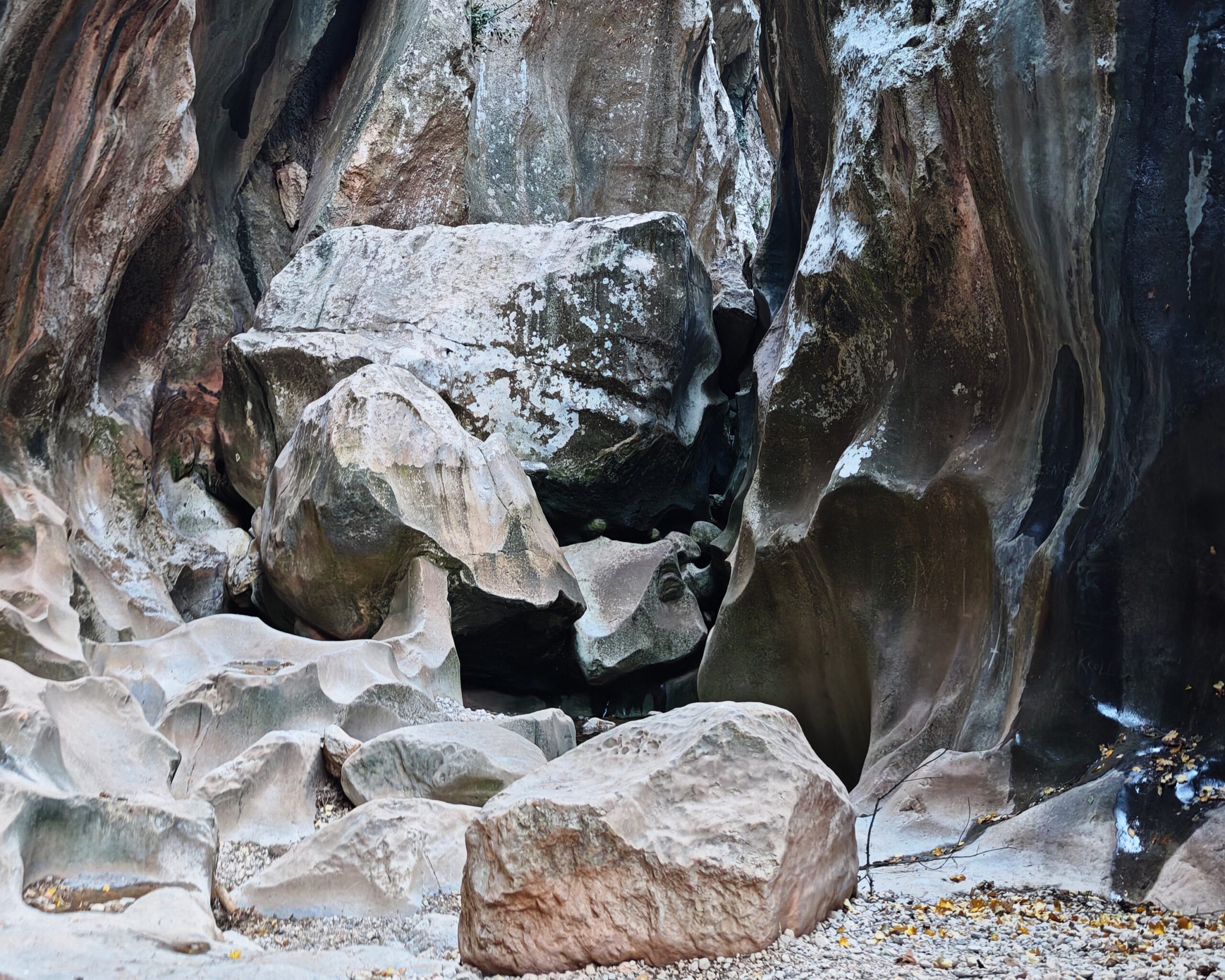
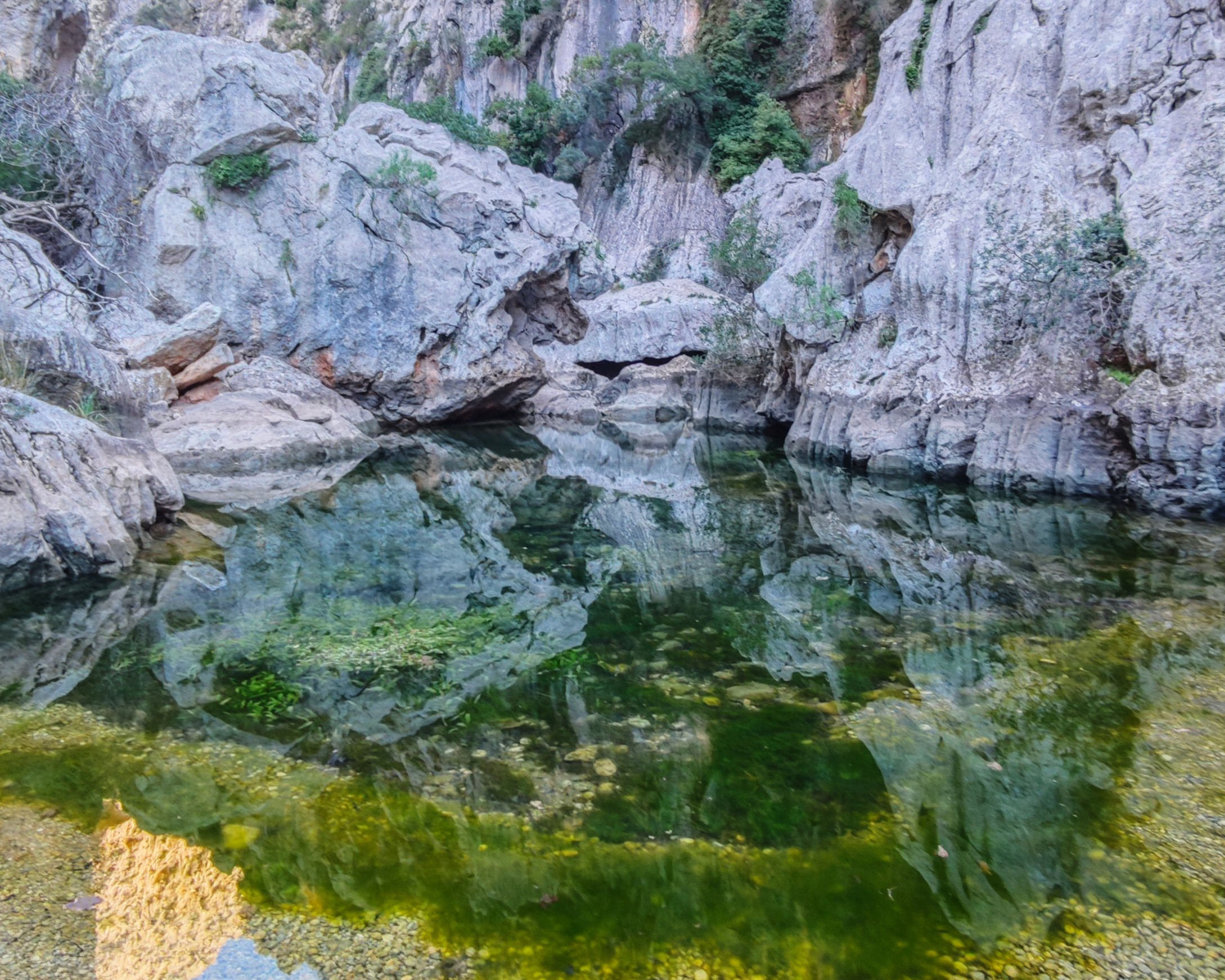
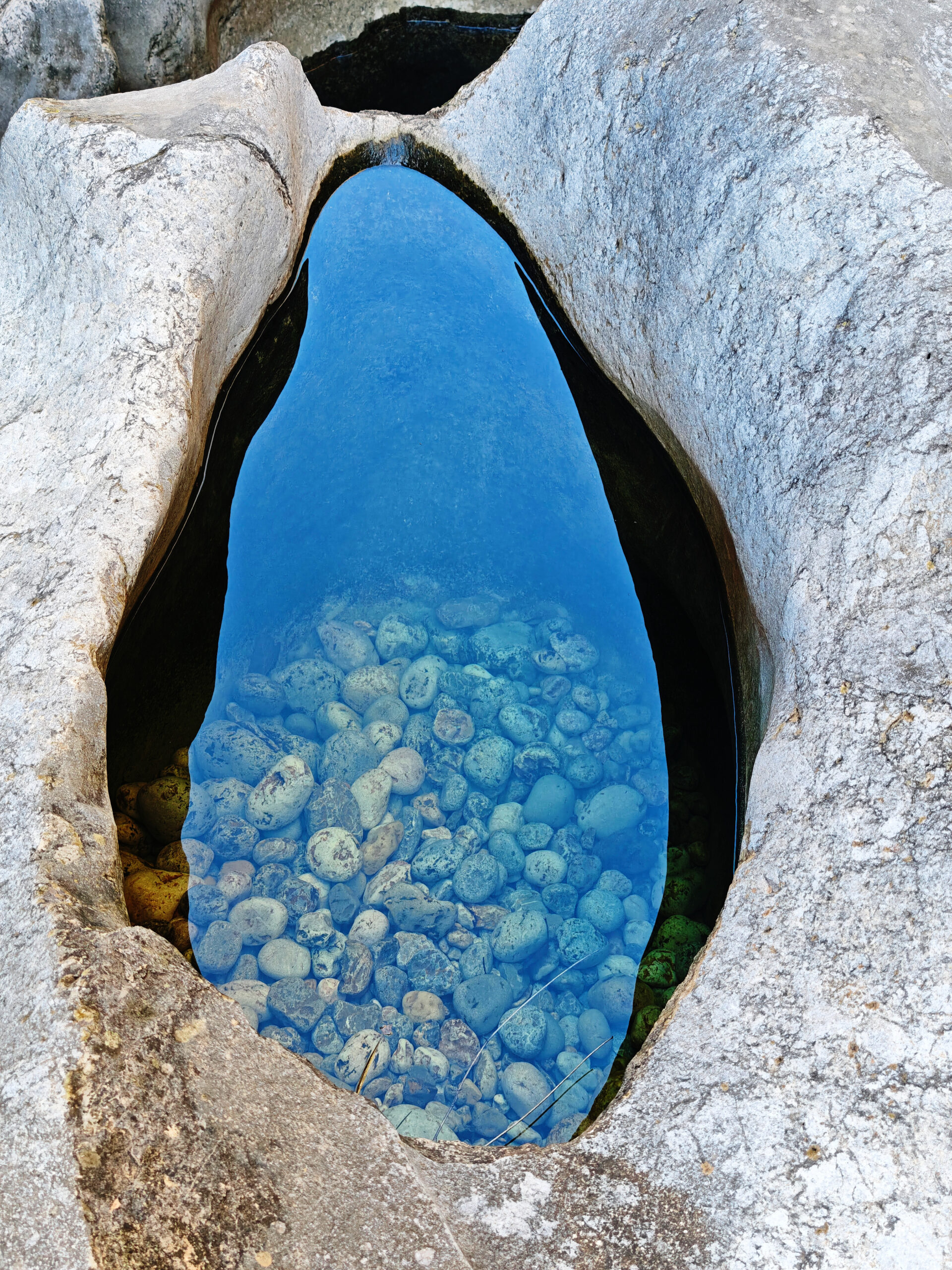
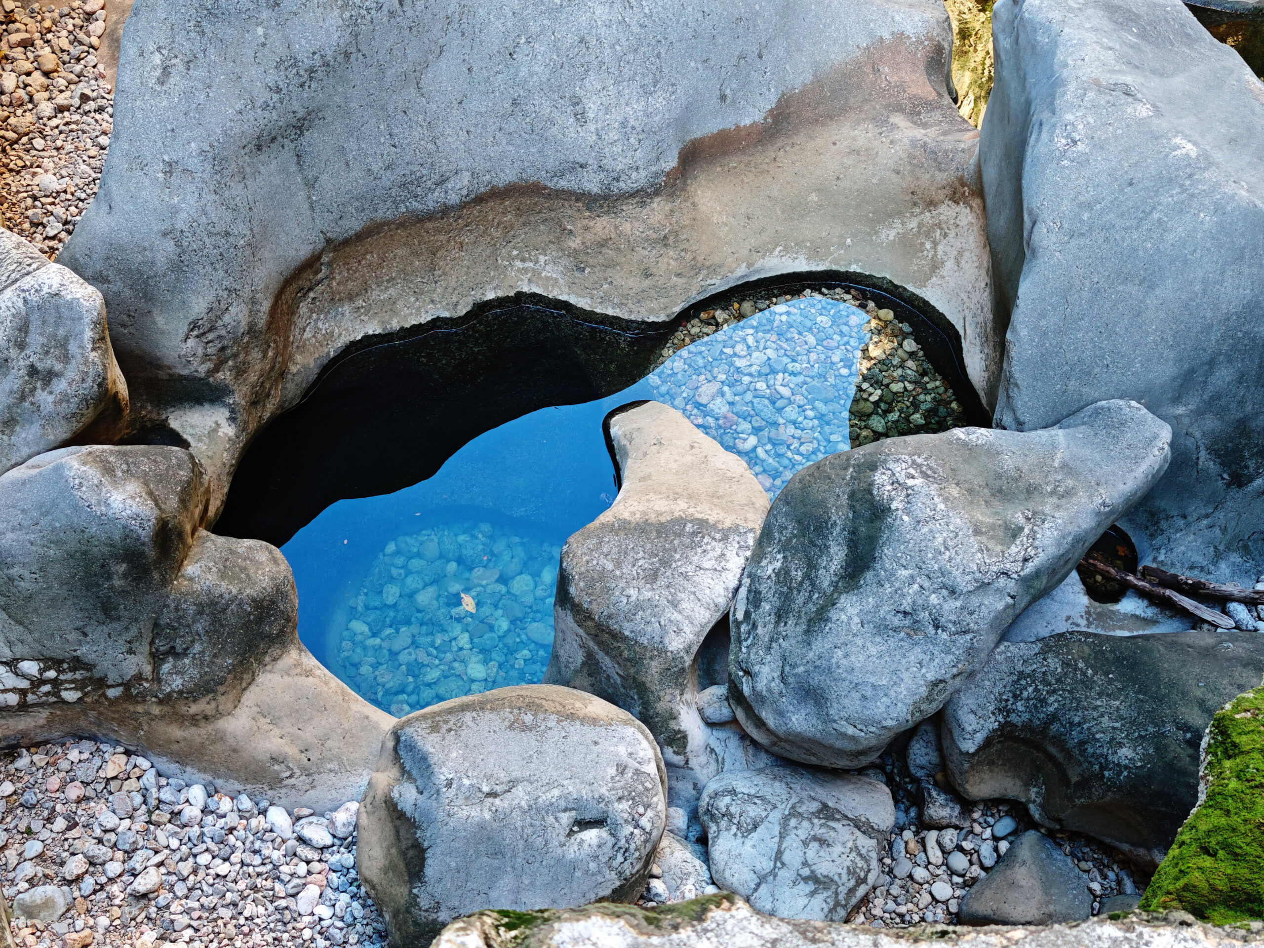
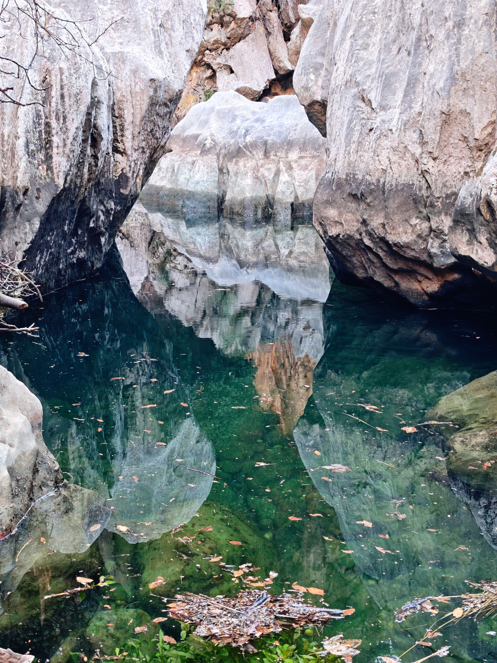
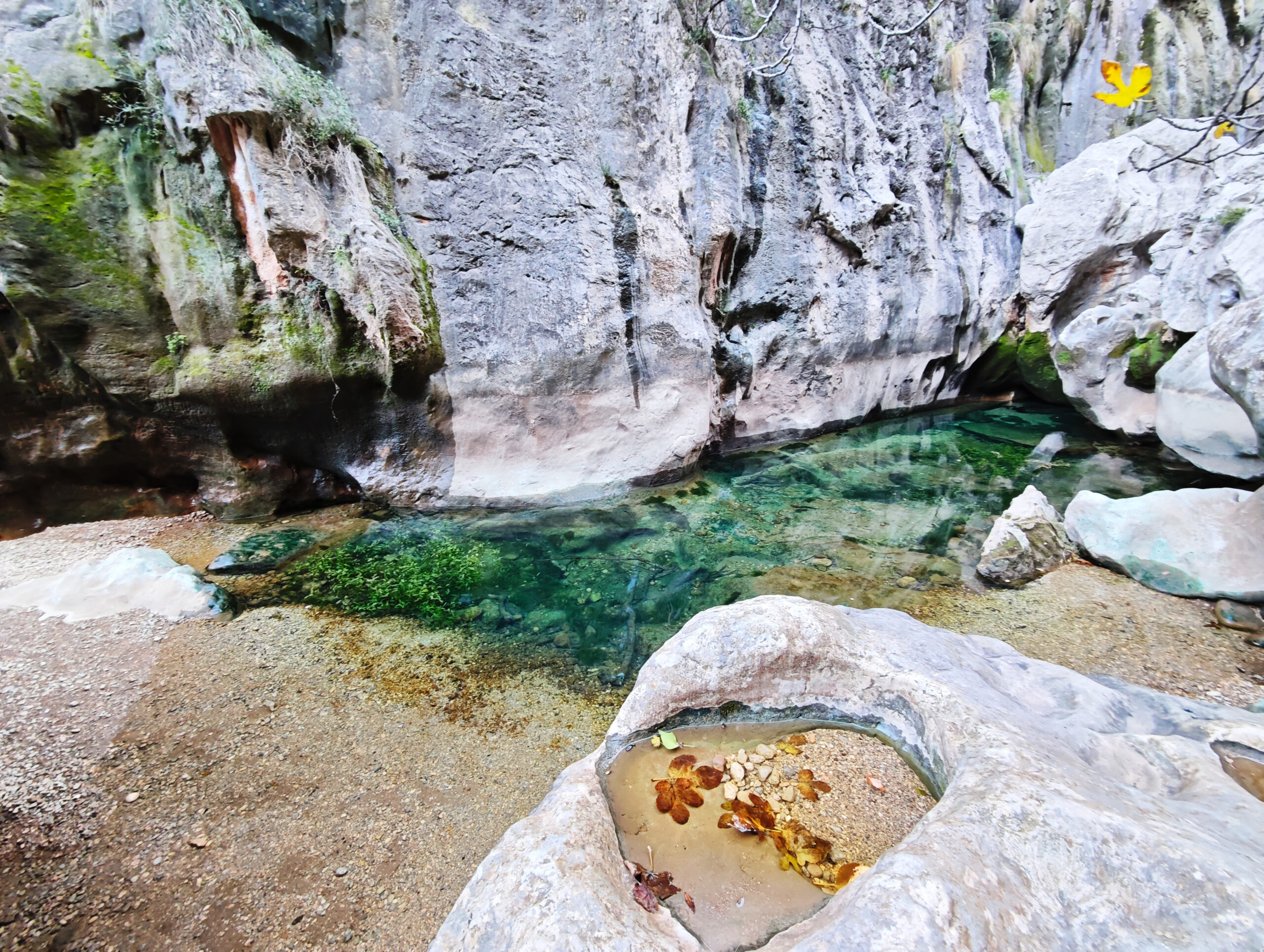
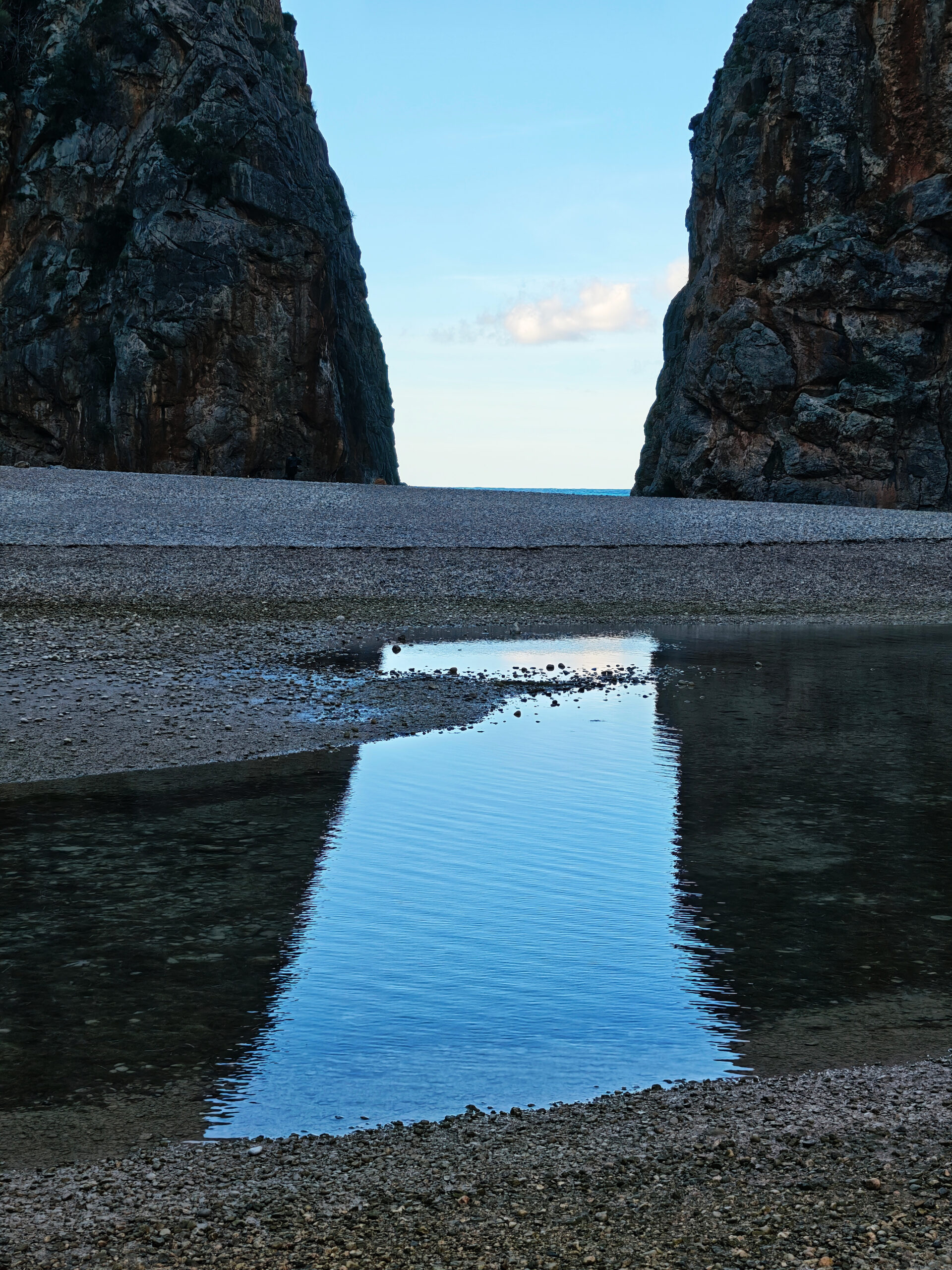
It should also be noted that water is almost always present in the numerous rock pools within the gorge! The amount depends on the intensity of rainfall in the preceding days and can render the gorge completely impassable! Even in the few shallow, gravelly sections where the path isn’t blocked by rocks, the water level can reach waist height. This poses a significant risk of drowning! The rock surfaces, which are often very smooth and polished, can cause you to lose all traction with your shoes when wet!
If you simply want to view the cove at the end of the gorge, it’s best to drive to the neighboring cove of Sa Calobra. From there, a tunnel has been carved through the rock, allowing you to easily reach the Torrent de Pareis on foot.
Highlights of the Torrent de Pareis Hike
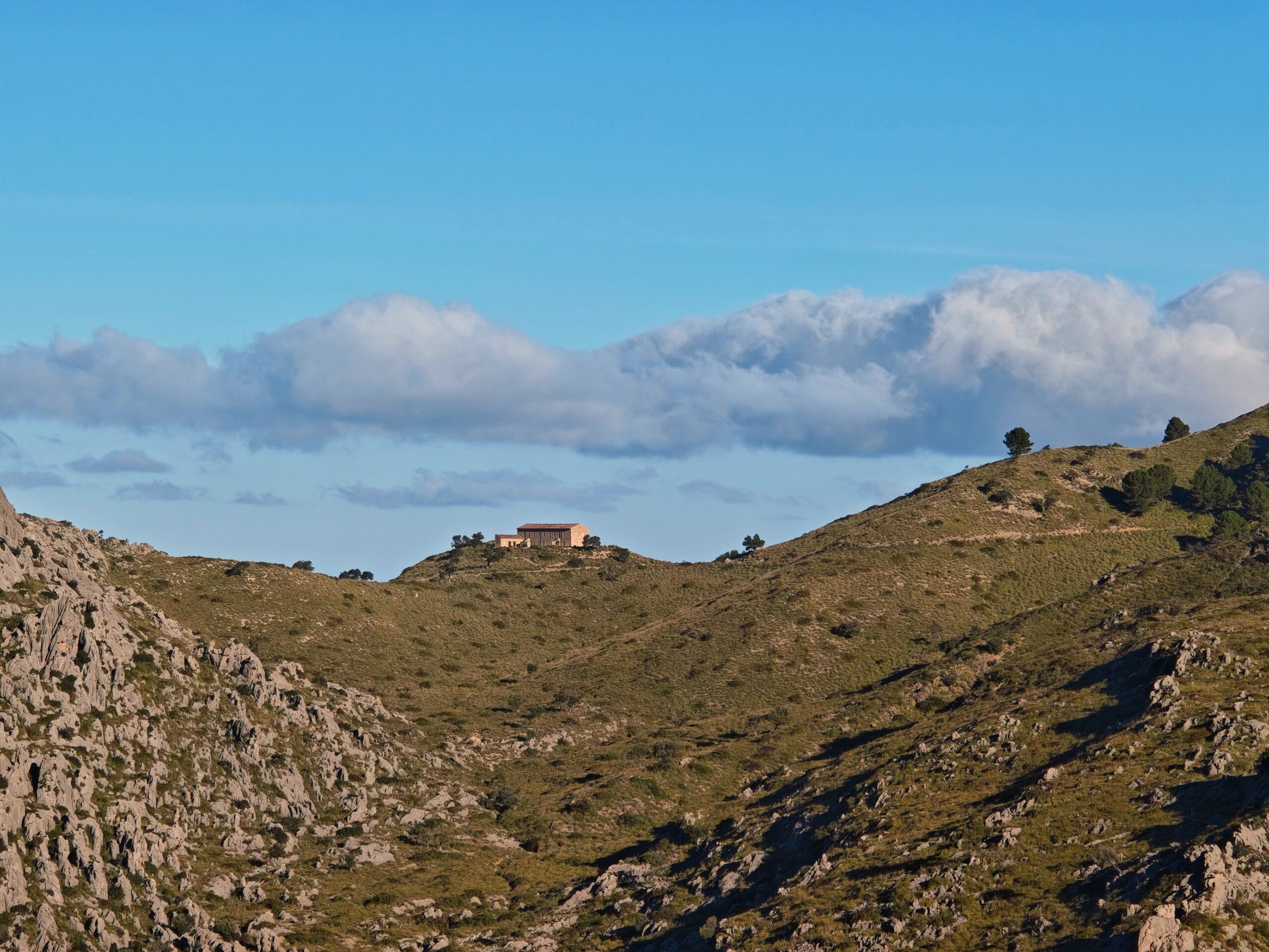
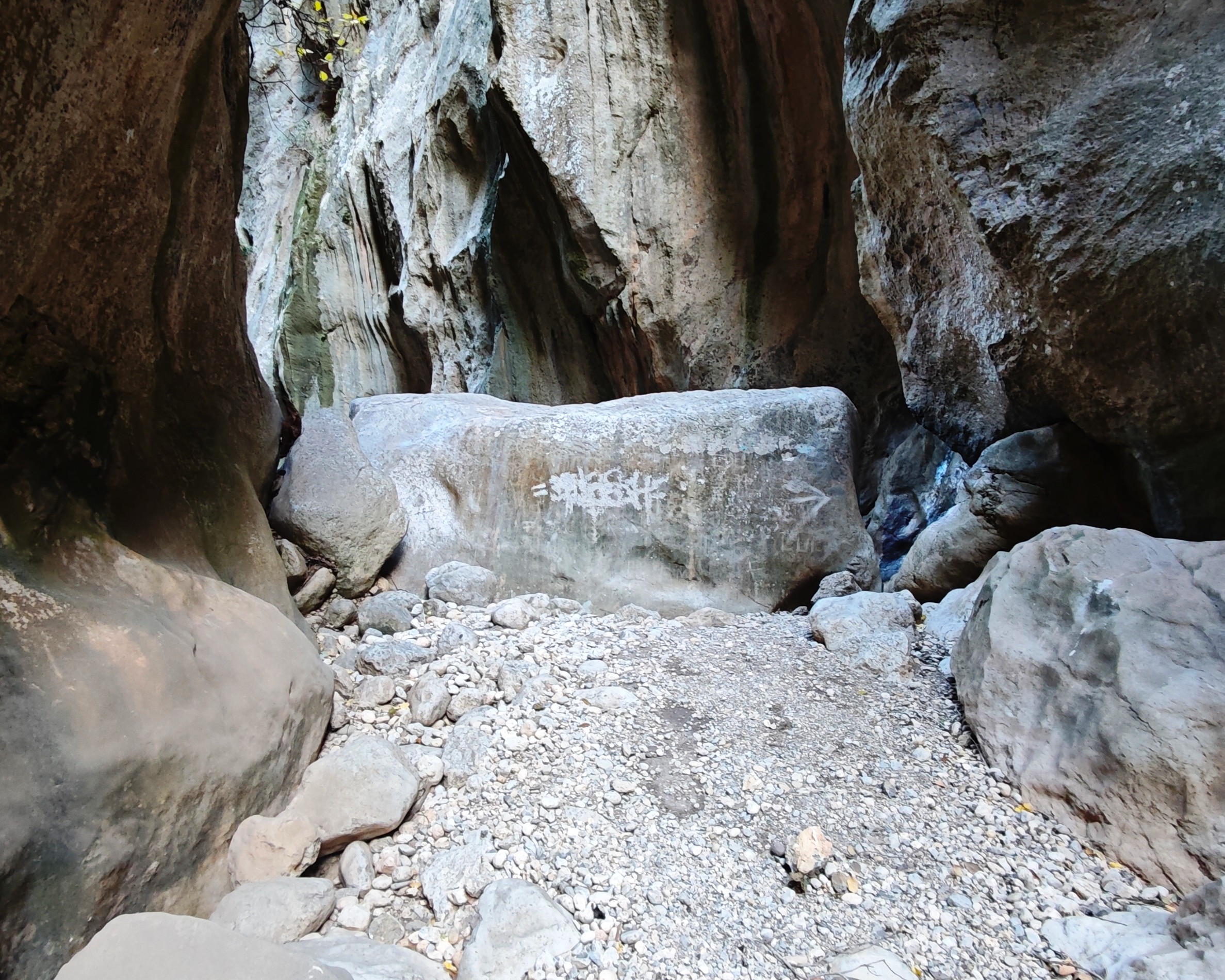
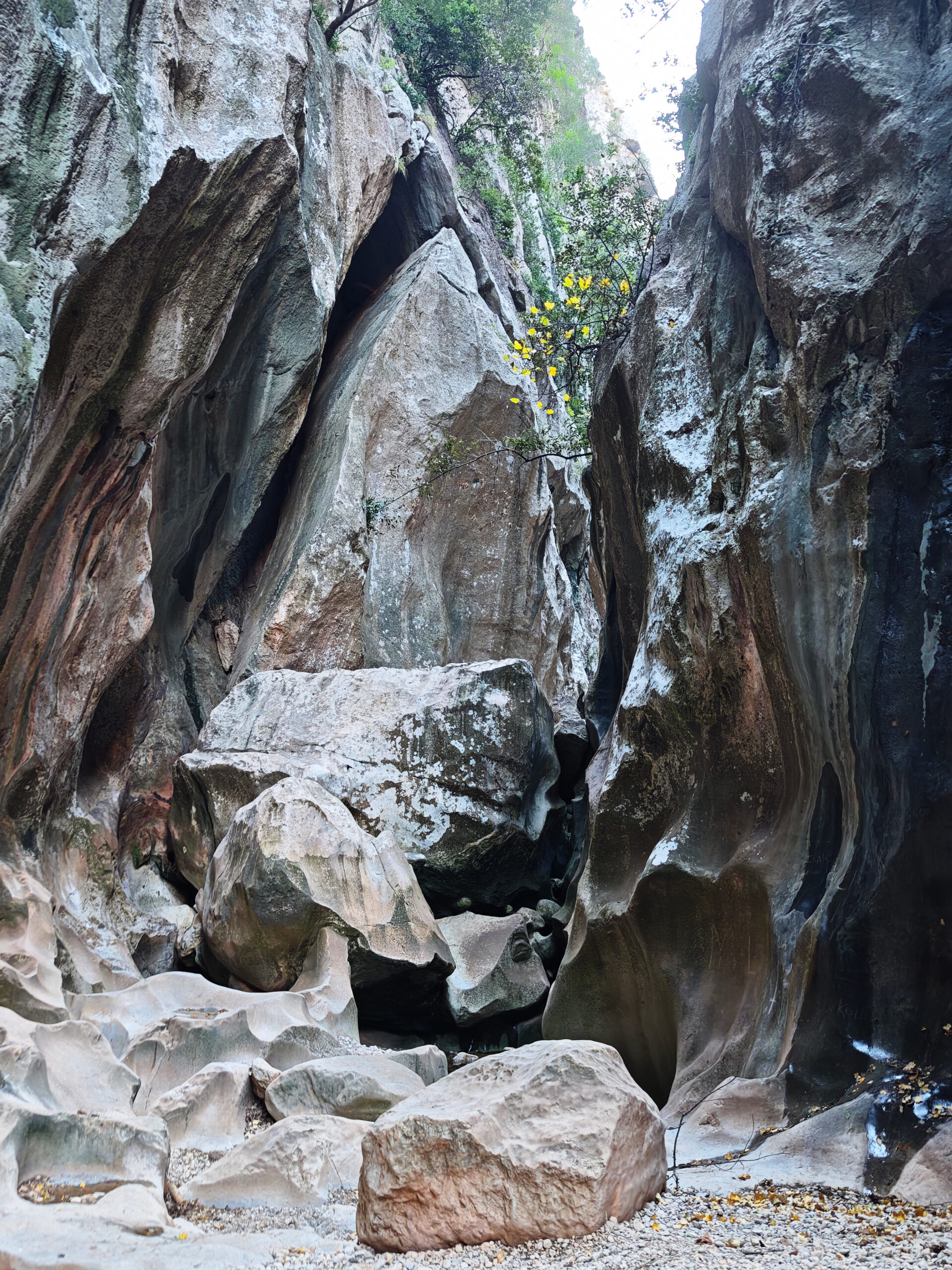
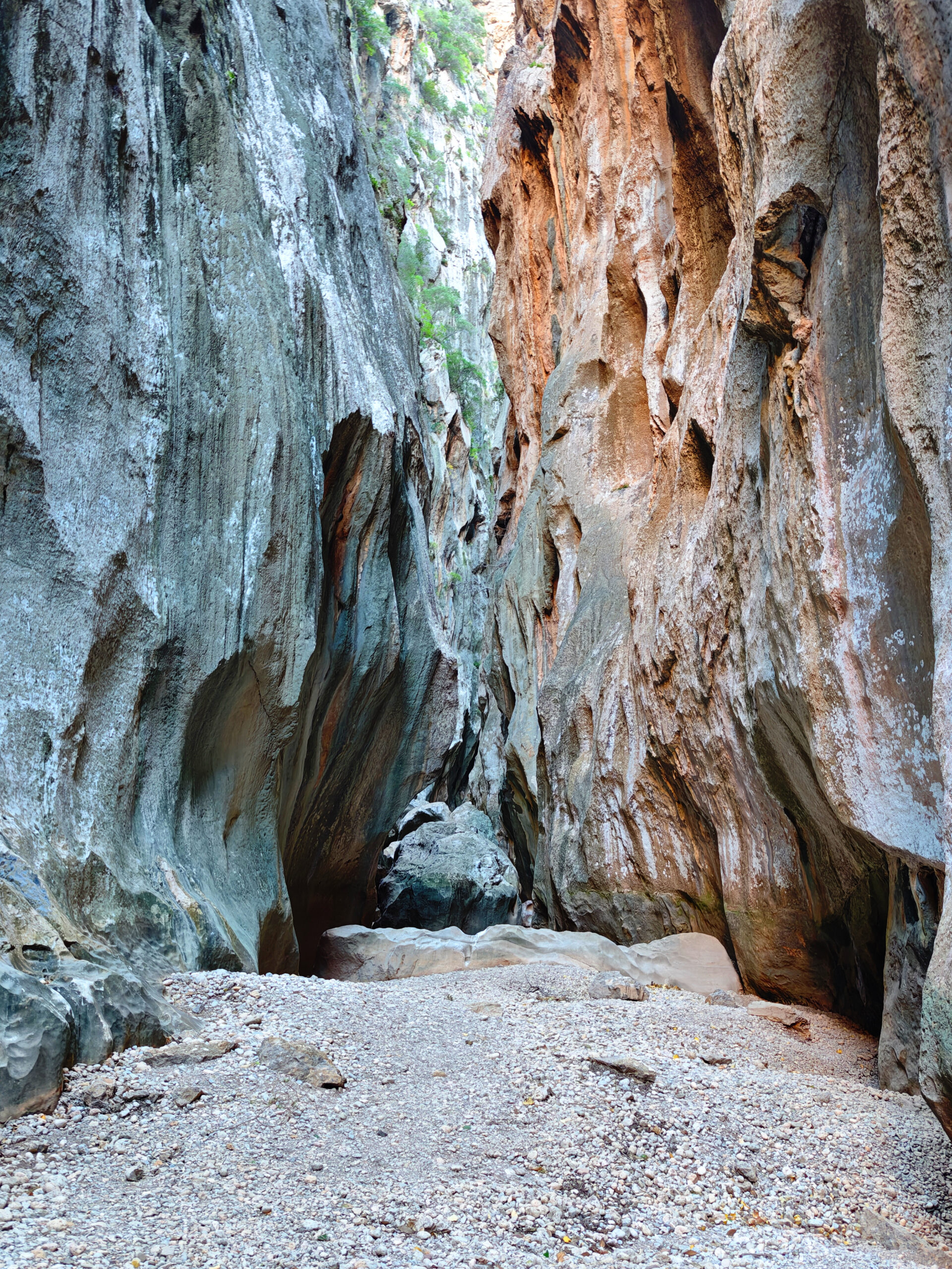
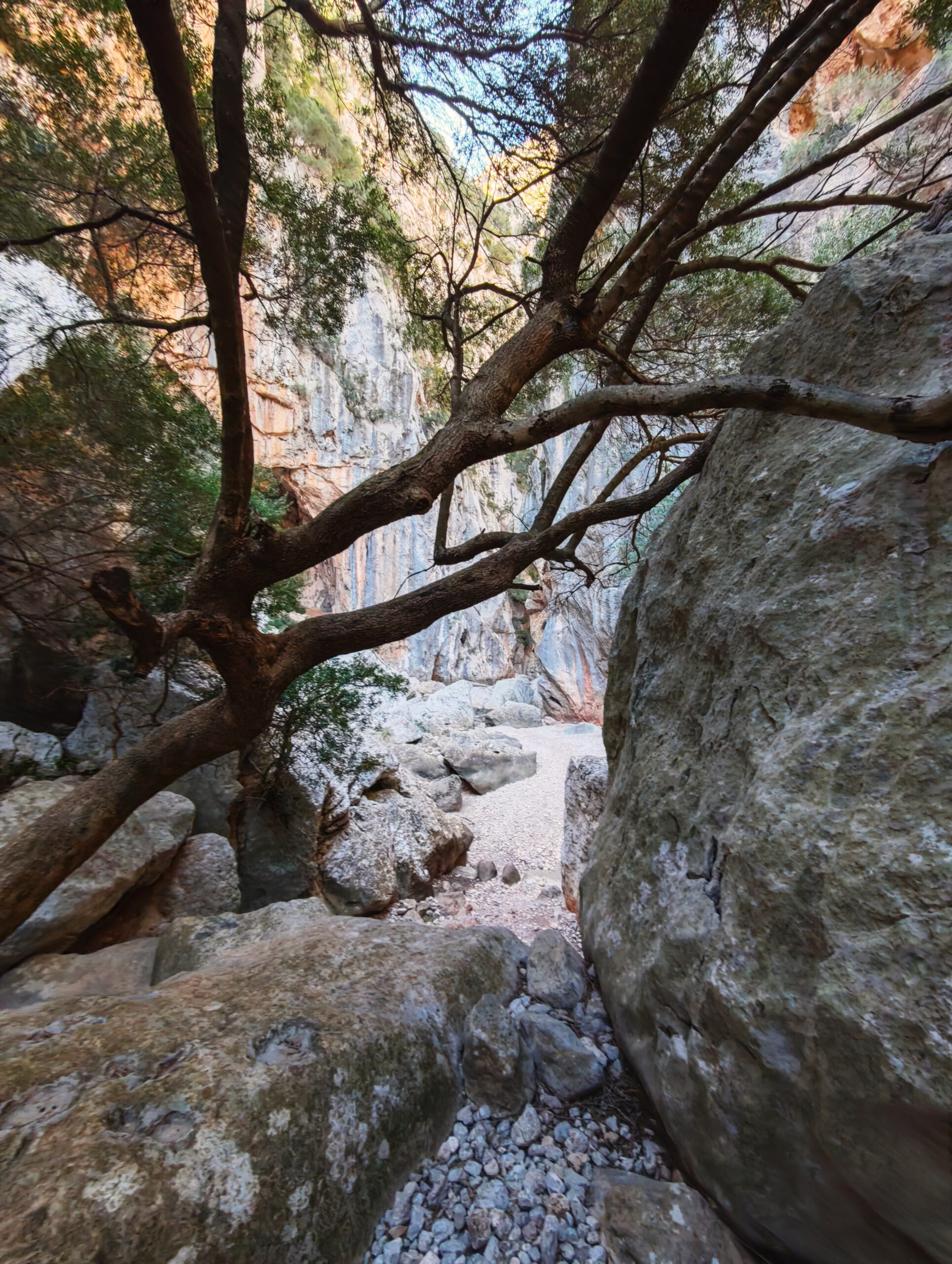
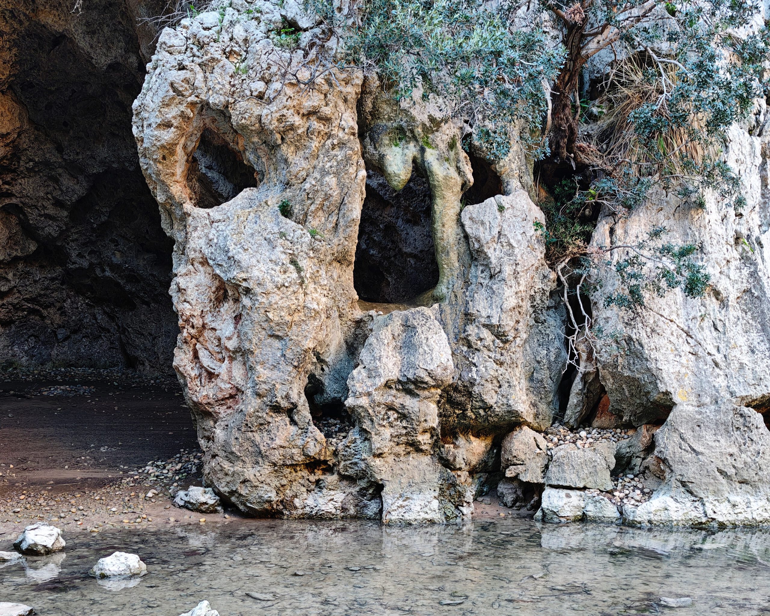
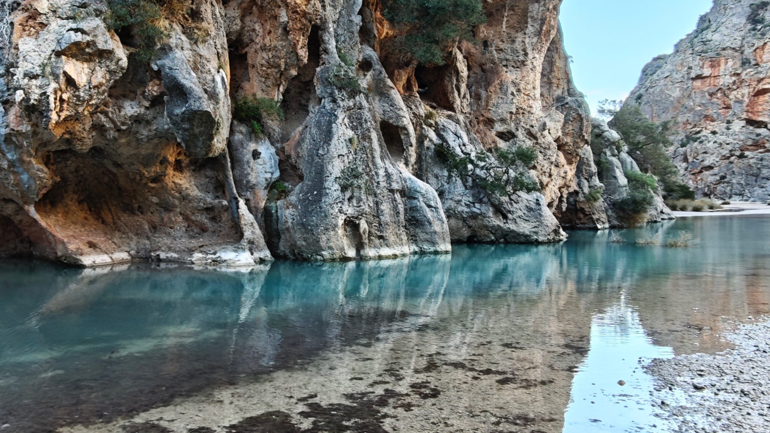
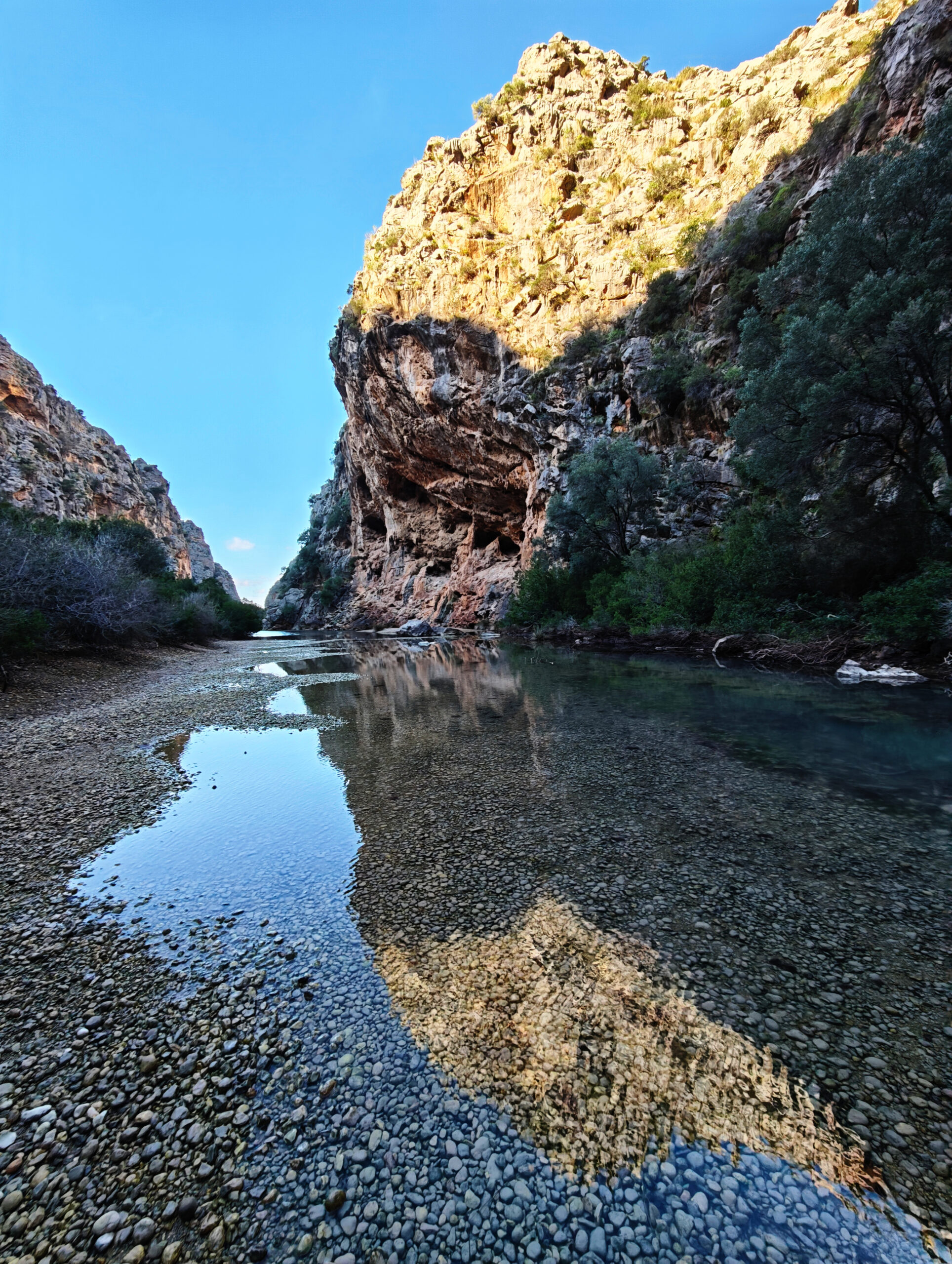
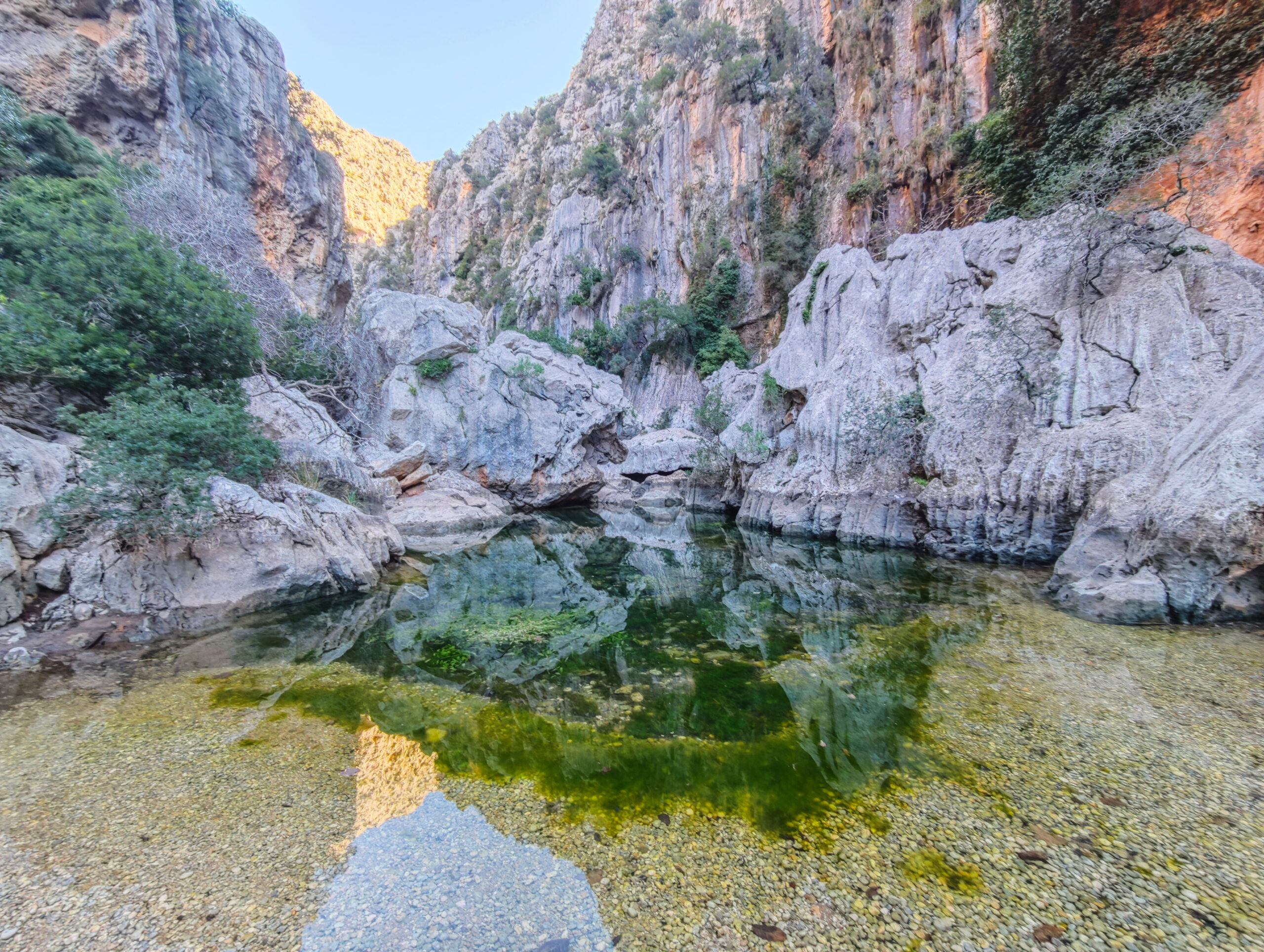
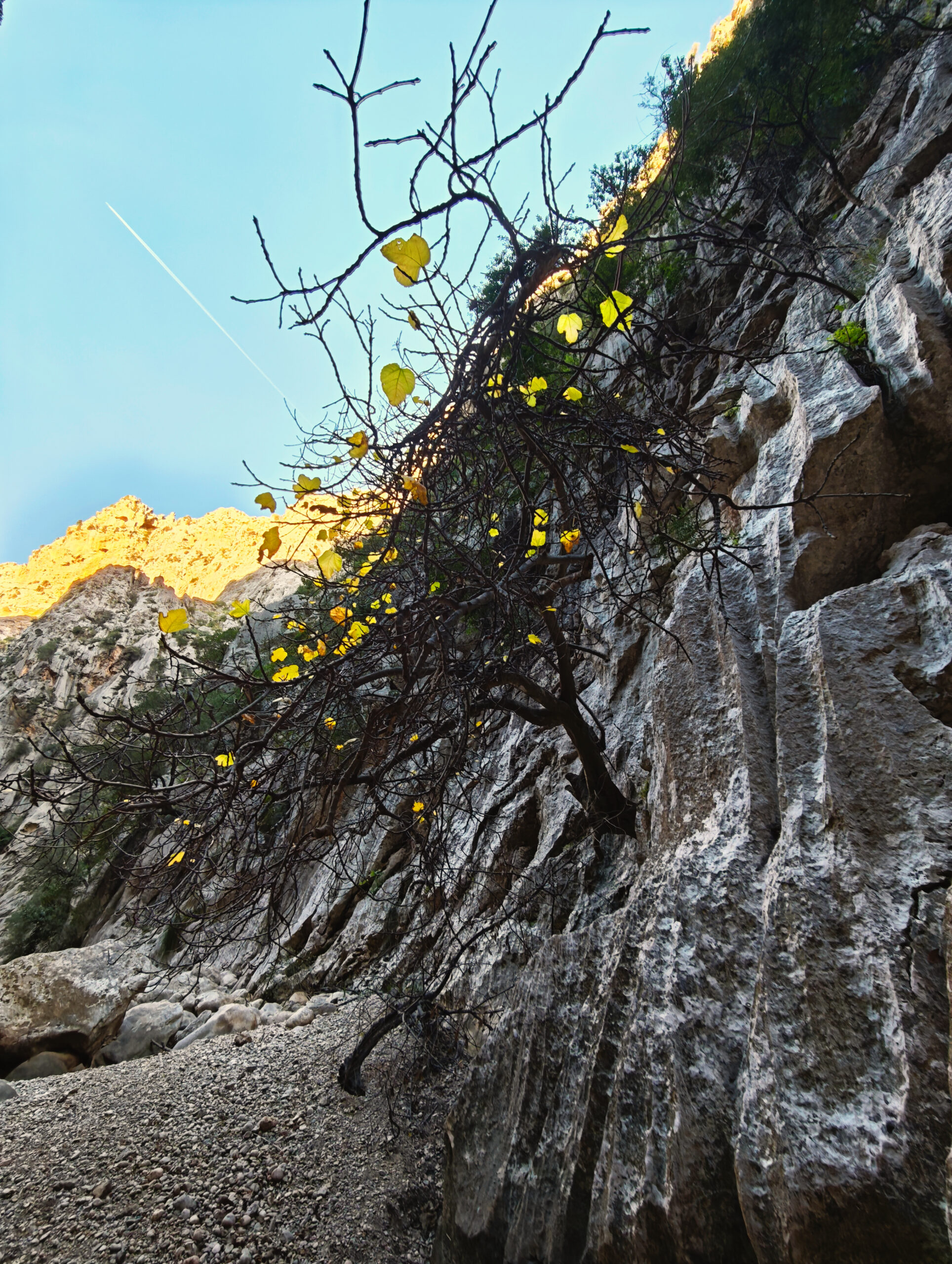
There’s no denying the gorge’s beauty and grandeur—see the photo gallery.
starting Point
On Ma-10, across from or just before the Antic Restaurant ( 39.826209, 2.846993).
Want some more manageable hikes?
Then take a look at our overview of all hikes on Mallorca!
Fotostrecke Torrent de Pareis
FREQUENTLY ASKED QUESTIONS ABOUT THE Torrent de Pareis Hike
On the Ma-10 opposite or shortly before the Antic Restaurant ( 39.826209, 2.846993).
Definitely the most difficult route we know on Mallorca and, from our point of view, currently not safe to hike.
At the very few easiest sections of the hike, you can simply walk, but on the overwhelming majority of the route you scramble over rock and scree. In addition, there are many dead ends and search movements that cost time and energy. From the car park to the bay, we needed 5 hours under otherwise ideal conditions. You should definitely not expect less.
Not in the sense that you cannot find the gorge or accidentally leave it. But you can definitely get extremely lost between the rocks. As described above, even tracks do not really help there.
To our knowledge, not officially. However, rainfall beforehand also rules out even attempting to hike through the gorge.
In Sa Calobra there are restaurants that are open seasonally. On the route itself, you are completely dependent on your own provisions.
See photo section.
Please take the warnings described further above seriously.
Weather on the Torrent de Pareis
We provide a 24-hour forecast for planning your Torrent de Pareis hike — including temperature, rain, sunshine, cloud cover, plus wind speed and wind direction, for both the start point and the destination.
Check the Weathermap FAQ for more details about the weather data!
Who’s behind Mallorca-Touren? Learn more here!
Have you done this hike and have additional notes? Send us a message!
Questions about the hikes, the maps, or what we offer? Find answers here!
We provide our hiking maps with a lot of care and genuine joy. If you truly like what we’re building here, we’d be very grateful for a donation!