

Sa Rateta hike
ROUTE OVERVIEW PUIG DE SA RATETA, ACCESS VIA THE GR-221
This tour takes you from the Cúber reservoir (Embassament de Cúber) via the GR-221 (dry-stone route) up to Puig de sa Rateta — a demanding route in the Tramuntana. Here you get the route, interactive map and GPX track plus our honest assessment of the effort required and orientation. As with all our tours, the GPX serves as a backup so that you can do the tour independently and in a relaxed way.
HIGHLIGHTS OF THE HIKE TO PUIG DE SA RATETA VIA THE GR-221
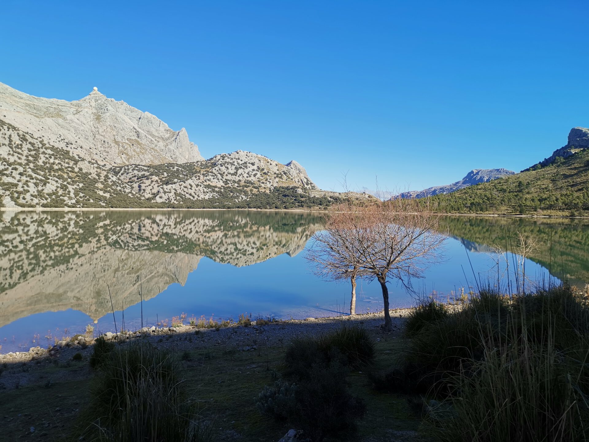
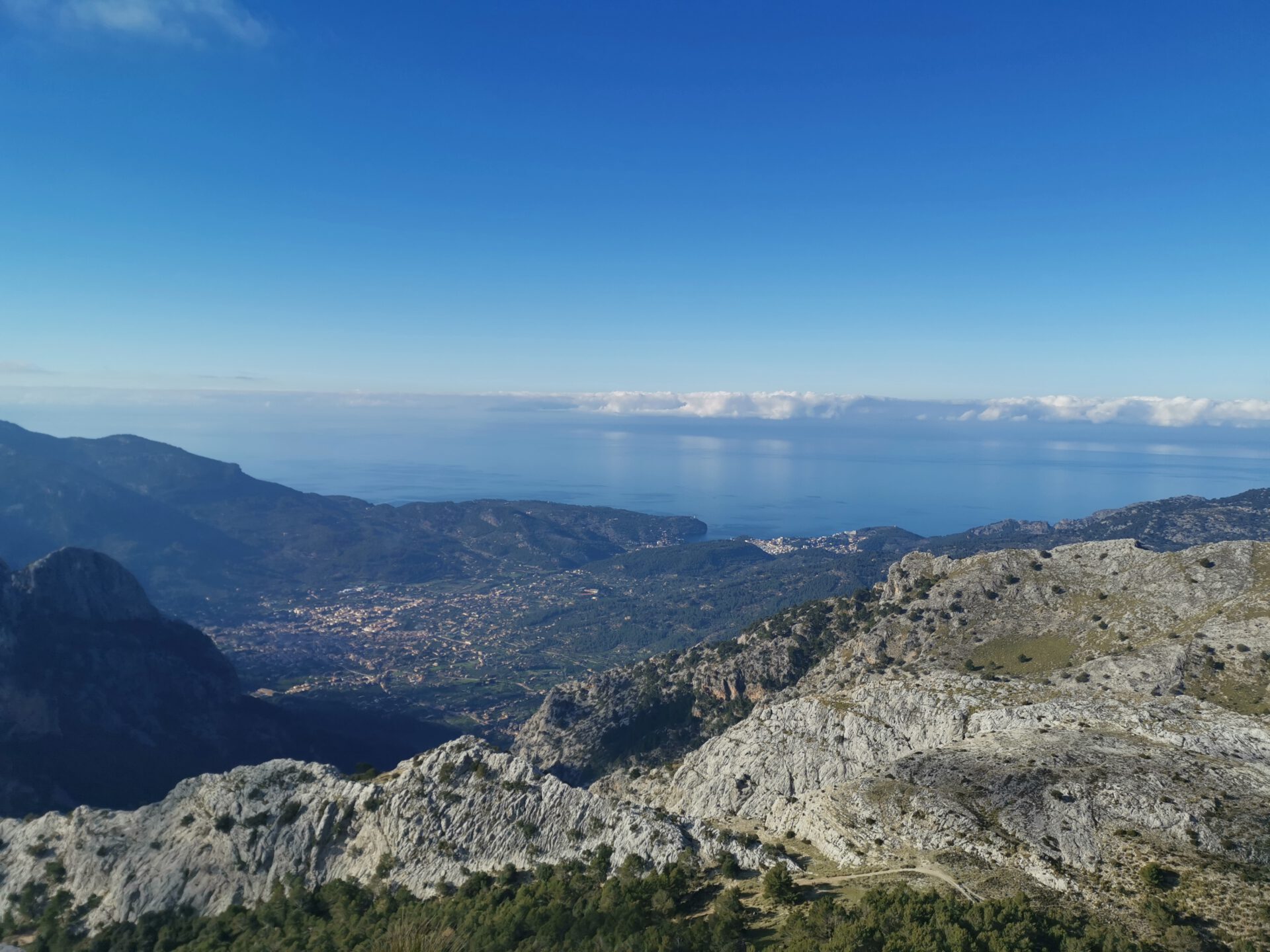
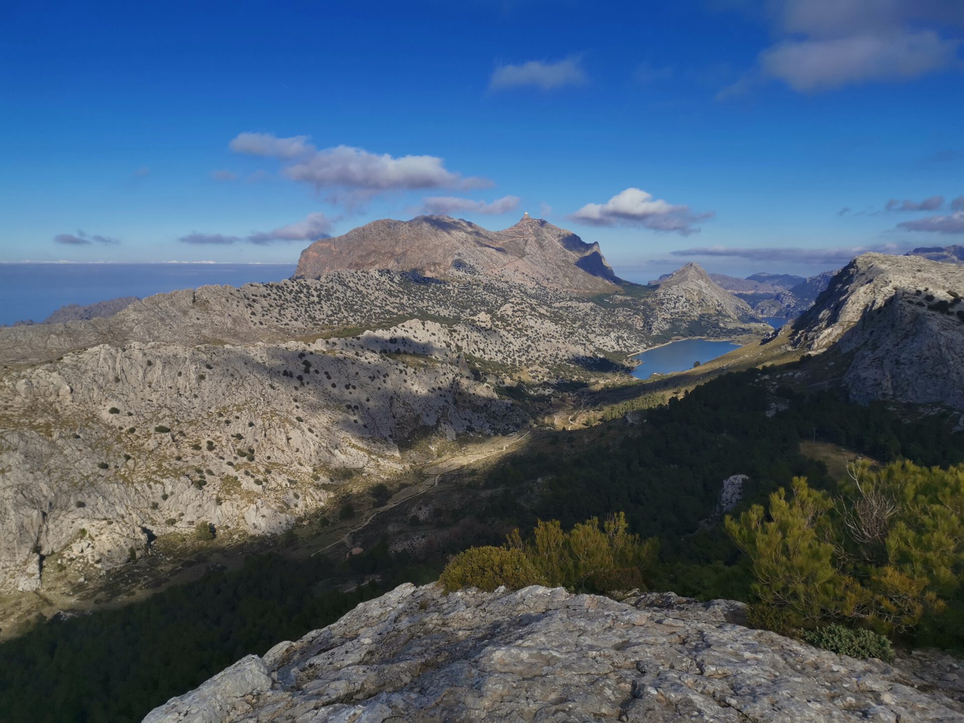
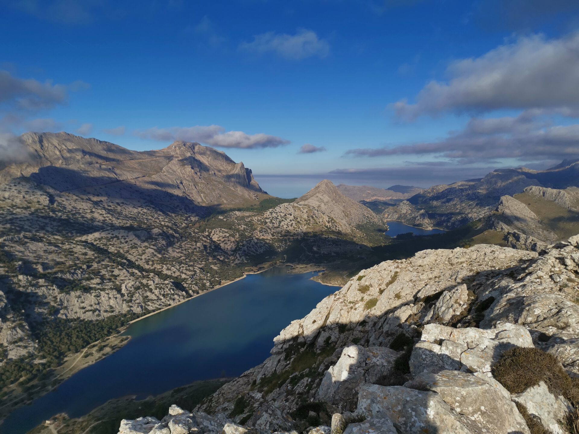
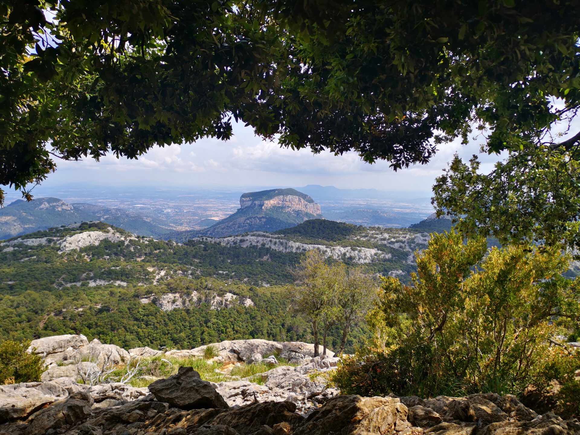
This hike includes everything Jörn loves—which is why it’s one of his favorites: a gentle, leisurely climb along the Cuber Reservoir that turns into a steep trail at Ofre and finally leads over the Franquesa, across many rocks, to Sa Rateta. Both the view from the Ofre over Sóller and the view from Sa Rateta of the Cuber Reservoir, the Gorg Blau, and the summit of Puig Major are breathtaking.
What to keep in mind
On this tour, the chosen descent from the summit of Sa Rateta is quite hard to find. If you lose your way, you quickly end up on scree fields that are not safely passable.
starting point
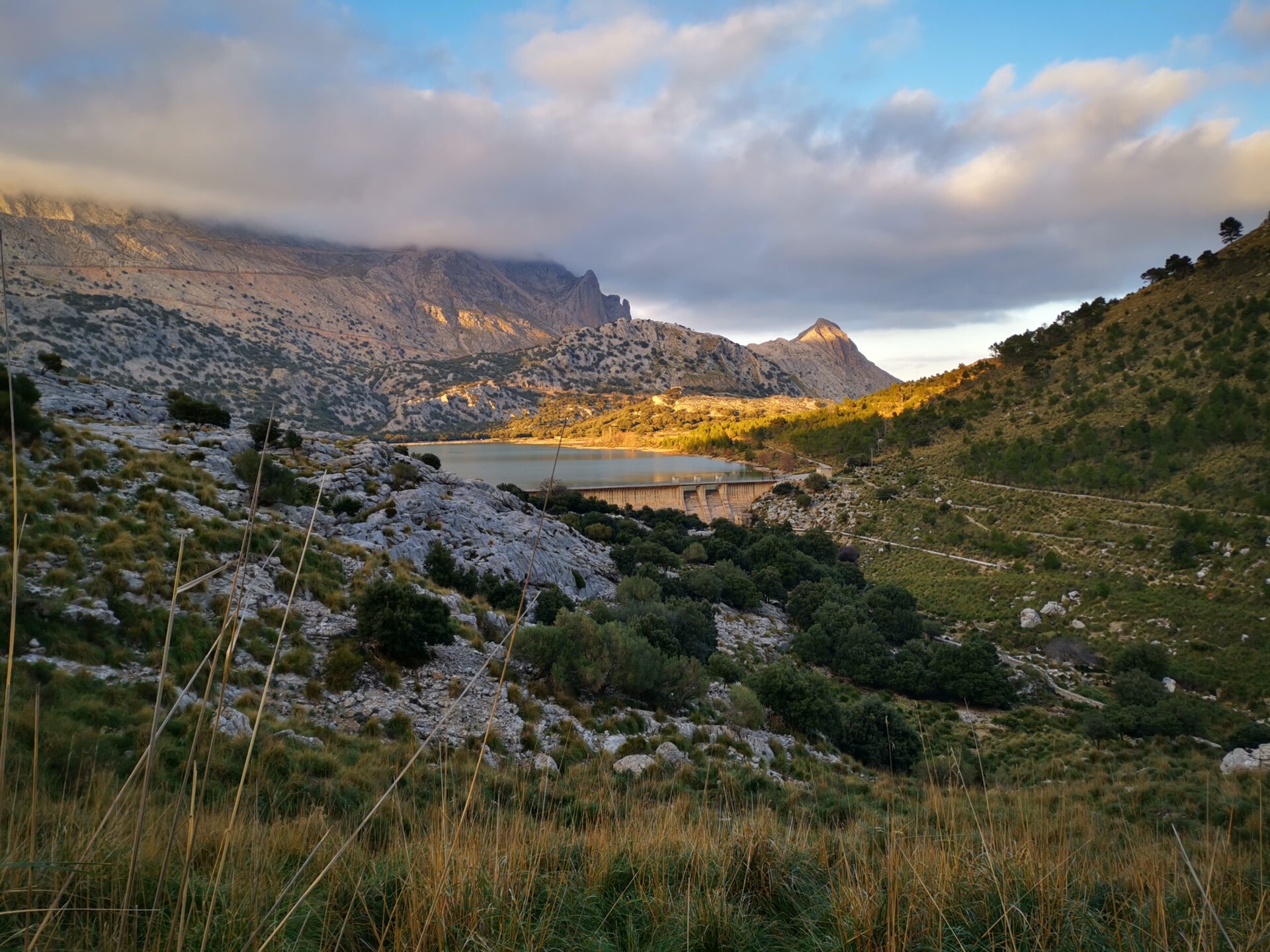
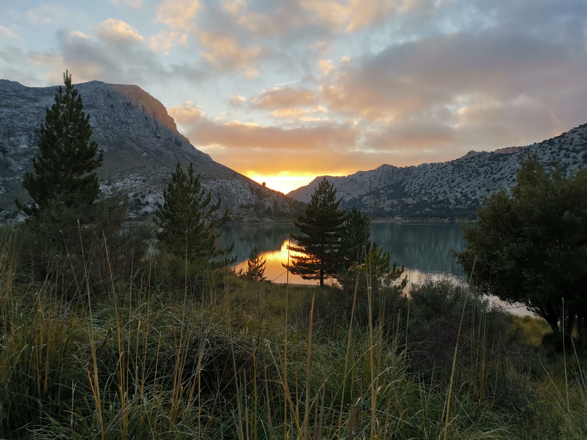
At the parking lot of the Cúber Reservoir ( 39.787091, 2.798953).
WANT MORE HIKES LIKE THIS?
Then take a look at our overview of all hikes on Mallorca! This route is part of our hikes in the Tramuntana m ountains. Also, the Sa Rateta belongs to the highest summits of the Tramuntana.
This route was also featured in our Best of Mallorca guide to Tramuntana hikes.
Route Overview: Puig de Sa Rateta, Access via El Verger, Alternative Descent
What to keep in mind
The ascent to Verger via the Pas de n’Alou is steep, and especially toward the end, you’ll need to use your arms and legs. The section following the ridge is also fenced-off private property, so you can’t follow the trails usually marked on maps. Instead, you’ll have to make your way through the underbrush along the fence and below the ridge.
The return route shown here, via the old snow trail on the back side of Sa Rateta, can of course also be combined with the first tour. It is definitely easier to find and walk!
starting point
At the parking lot of the Cúber Reservoir ( 39.787091, 2.798953).
WANT MORE HIKES LIKE THIS?
Then take a look at our overview of all hikes on Mallorca! This route is part of our hikes in the Tramuntana mountains. Also, the Sa Rateta belongs to the highest summits of the Tramuntana.
This route was also featured in our Best of Mallorca guide to Tramuntana hikes.
FREQUENTLY ASKED QUESTIONS ABOUT THE Sa Rateta Hike
At the car park of the Cúber reservoir ( 39.787091, 2.798953). Arriving early is worthwhile, as parking spaces are limited and the hiking area is popular.
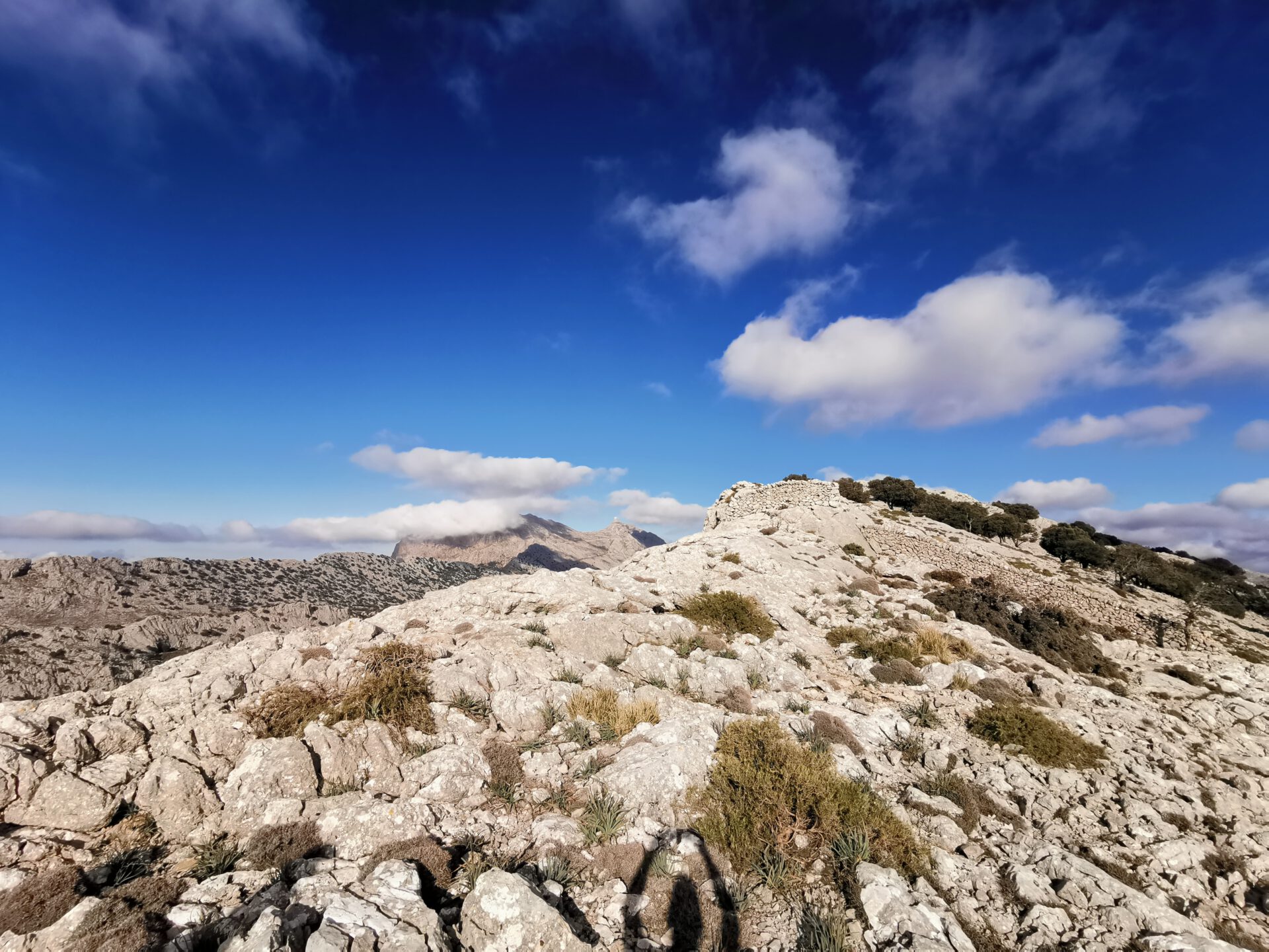
The hike starts off very easy technically and then gets progressively more difficult. At first, the trail leads through the valley along wide hiking paths. However, the ascent to Ofre is already significantly more difficult, and the hike across the summits takes place over cracked and fissured rocks, which require a sure footing and considerable strength. The descent, which we use in the first route, is quite difficult because it’s very easy to get lost. Combined with the total length, we classify both route variants as difficult!
Allow about 4 to 5 hours of pure walking time for the shorter route and about 5 to 6 hours for the longer one — breaks and time for the views are not yet included.
The route is not marked beyond the usual cairns. Thanks to our browser-based interactive 2D map with live location and illustrated route description, however, it is quite manageable even for people unfamiliar with the area.
No — unlike Puig Roig, this route is, according to our current knowledge, accessible at any time.
No. We are here on the highest peaks in the heart of the Tramuntana Mountains. The entire route runs through undeveloped terrain. You must bring all your own water and food!
This hike includes everything Jörn loves—which is why it’s one of his favorites: a gentle, leisurely climb along the Cuber Reservoir that turns into a steep trail at Ofre and finally leads over the Franquesa, across many rocks, to Sa Rateta. Both the view from the Ofre over Sóller and the view from Sa Rateta of the Cuber Reservoir, the Gorg Blau, and the summit of Puig Major are breathtaking.
The descent from the summit of Sa Rateta shown in the first tour is quite hard to find. If you lose your way, you quickly end up on scree fields that are definitely not safely passable.
Weather on the Sa Rateta hike
We provide a 24-hour forecast for planning your Sa Rateta hike — including temperature, rain, sunshine, cloud cover, plus wind speed and wind direction, for both the start point and the destination.
Check the Weathermap FAQ for more details about the weather data!
Who’s behind Mallorca-Touren? Learn more here!
Have you done this hike and have additional notes? Send us a message!
Questions about the hikes, the maps, or what we offer? Find answers here!
We provide our hiking maps with a lot of care and genuine joy. If you truly like what we’re building here, we’d be very grateful for a donation!