

Ferrutx hike
Route Overview Puig de Ferrutx
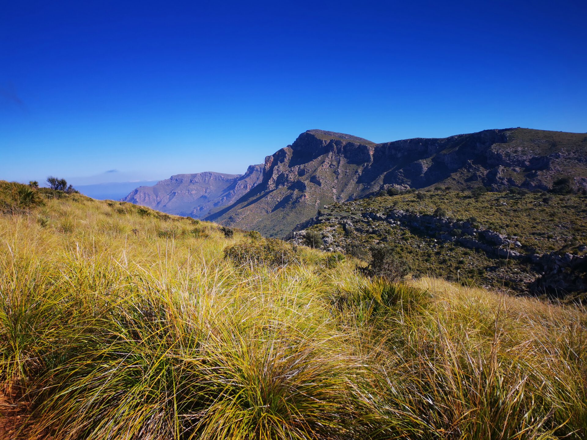
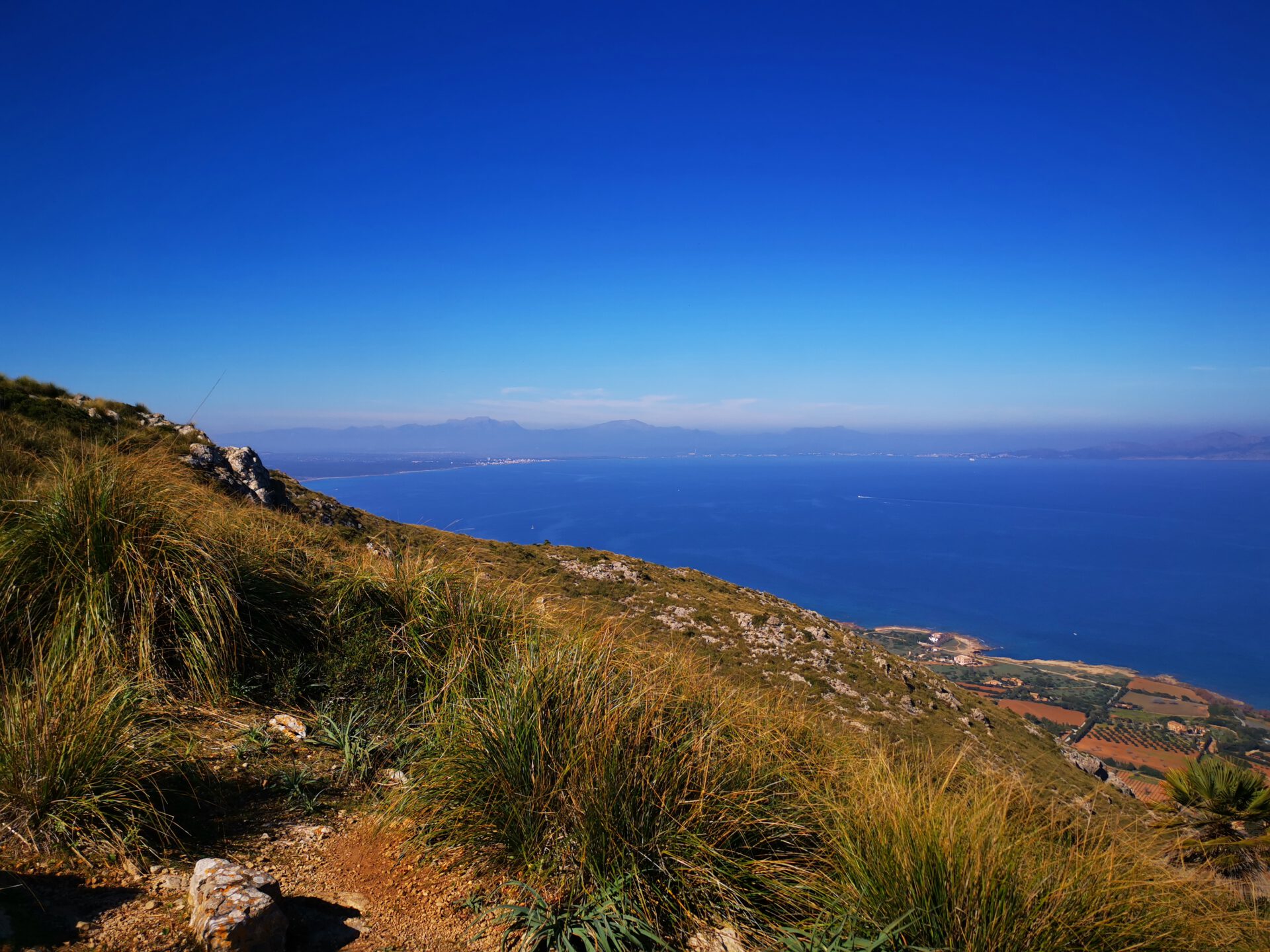
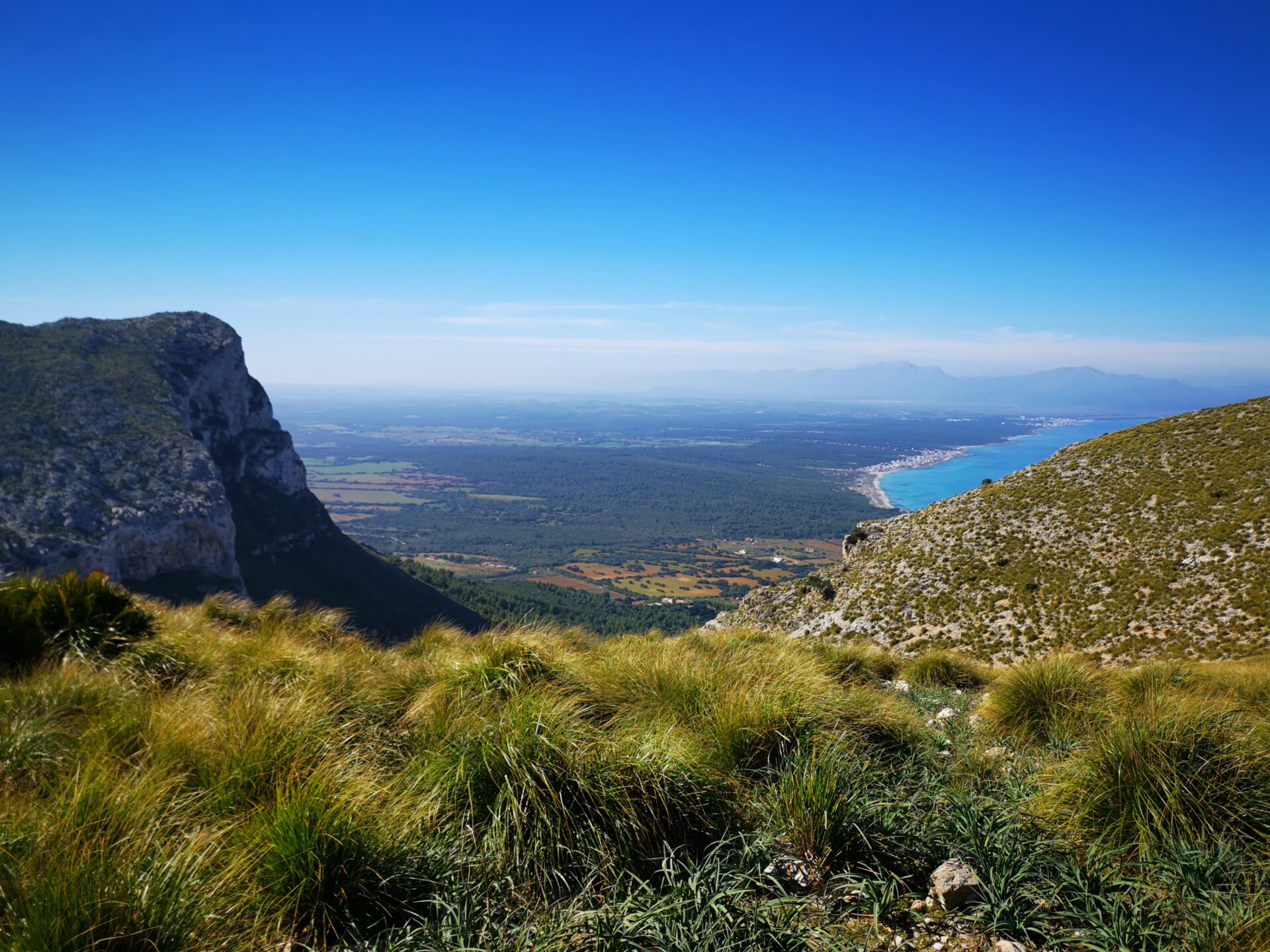
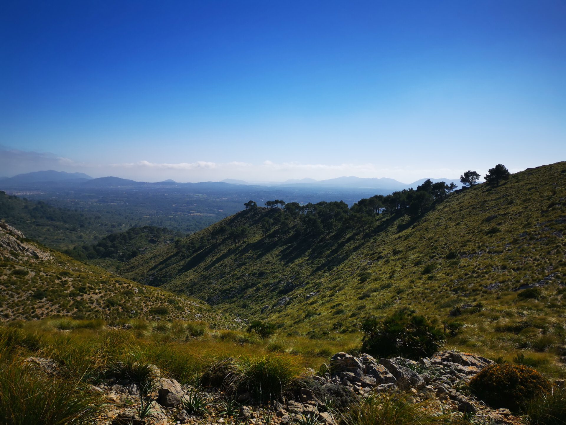
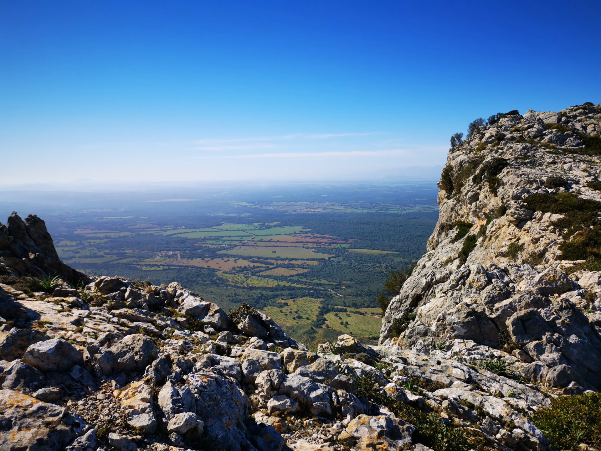
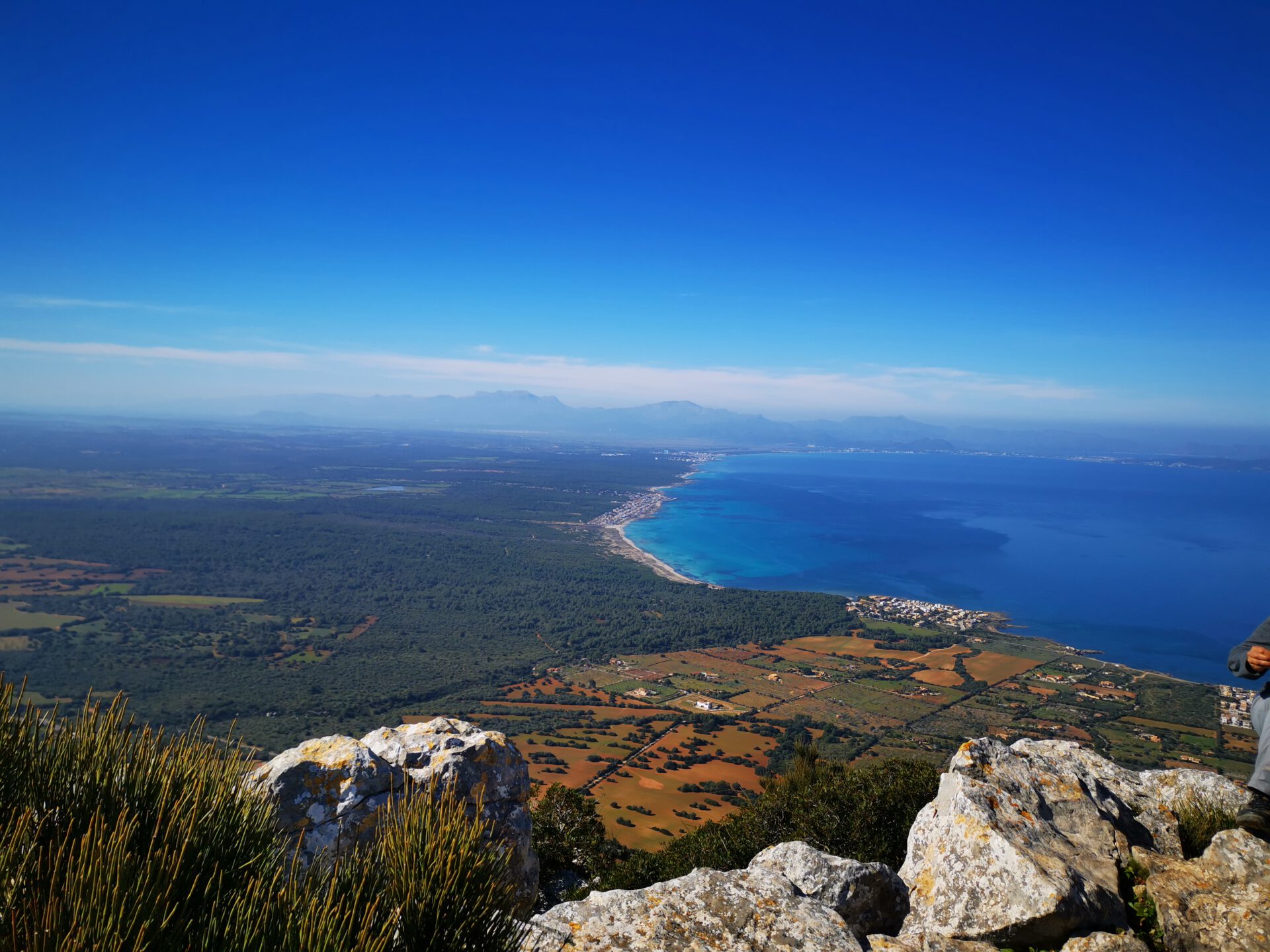
This tour takes you to Puig de Ferrutx in the Serra de Llevant — with one of the most impressive views over the Bay of Alcúdia. Here you will find the route, map and GPX track, plus our honest assessment of the effort required and navigation. Ideal if you want to explore Mallorca independently: navigation works directly in the browser — and with the GPX you have a solid backup while on the way.
Highlights of the Ferrutx hike
What to keep in mind
The hike starts in front of the entrance to the grounds of the Ermita de Betlem, at the height of the car park on the left-hand side. So do not go through the gate onto the grounds of the Ermita, but turn left beforehand.
starting point
At the car park of the Ermita de Betlem ( 39.736421, 3.312338).
WANT MORE HIKES LIKE THIS?
Then take a look at our overview of all hikes on Mallorca! This hike belongs to the routes in the Serra de Llevant.
FREQUENTLY ASKED QUESTIONS ABOUT THE Ferrutx hike
At the car park of the Ermita de Betlem ( 39.736421, 3.312338).
The tour is fairly easy, as the ascents are moderate and the paths are clearly visible and easy to walk.
The pure walking time is about 2.5 hours. For breaks and photos, you should allow 3–4 hours in total.
The paths are largely clearly visible and orientation is therefore quite easy. With our interactive 2D map with live location, it should be absolutely no problem — once you have found the starting point at the car park.
No! Like all our routes, you can access the route directly in the browser with GPS location — without an app or registration. Just make sure you bring enough battery life or take a power bank for your smartphone with you!
Fantastic view over the Bay of Alcudia from the summit of Ferrutx! The Ermita also invites you to pay a visit afterwards!
The hike starts in front of the entrance to the grounds of the Ermita de Betlem, at the height of the car park on the left-hand side. So do not go through the gate onto the grounds of the Ermita, but turn left beforehand.
Weather on the Ferrutx hike
We provide a 24-hour forecast for planning your Ferrutx hike — including temperature, rain, sunshine, cloud cover, plus wind speed and wind direction, for both the start point and the destination.
Check the Weathermap FAQ for more details about the weather data!
Who’s behind Mallorca-Touren? Learn more here!
Have you done this hike and have additional notes? Send us a message!
Questions about the hikes, the maps, or what we offer? Find answers here!
We provide our hiking maps with a lot of care and genuine joy. If you truly like what we’re building here, we’d be very grateful for a donation!