

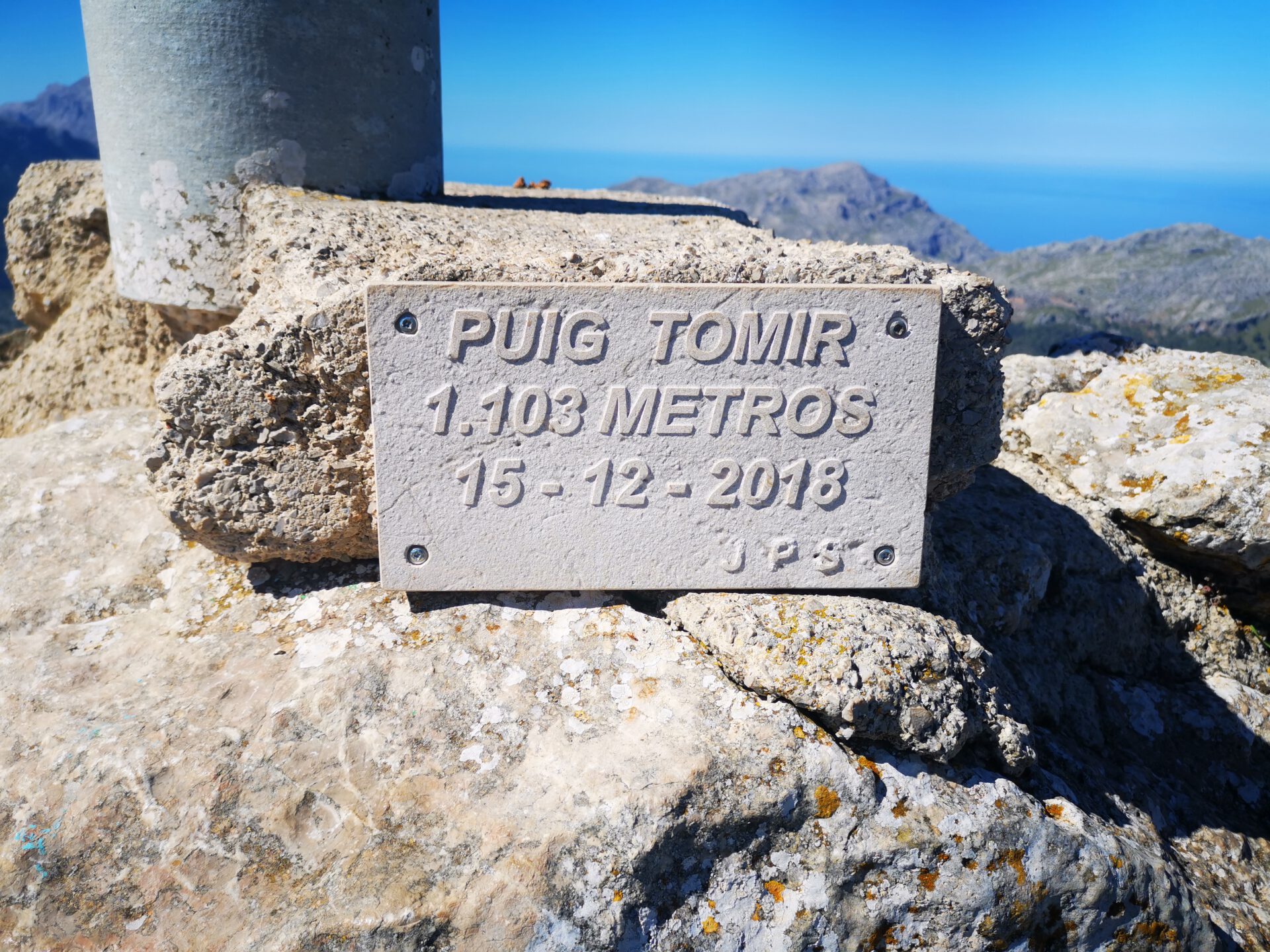
Tomir hike
Route Overview Puig Tomir
This hike takes you up Puig Tomir above the Lluc Monastery—short, steep, and just right if you’re looking for a challenging summit hike in the Serra de Tramuntana. Here you’ll find the route, an interactive map, and our overview of the difficulty, navigation, and technical sections; as an offline backup, you’ll also receive the GPX track (in case you lose signal along the way).
Highlights of the Tomir hike
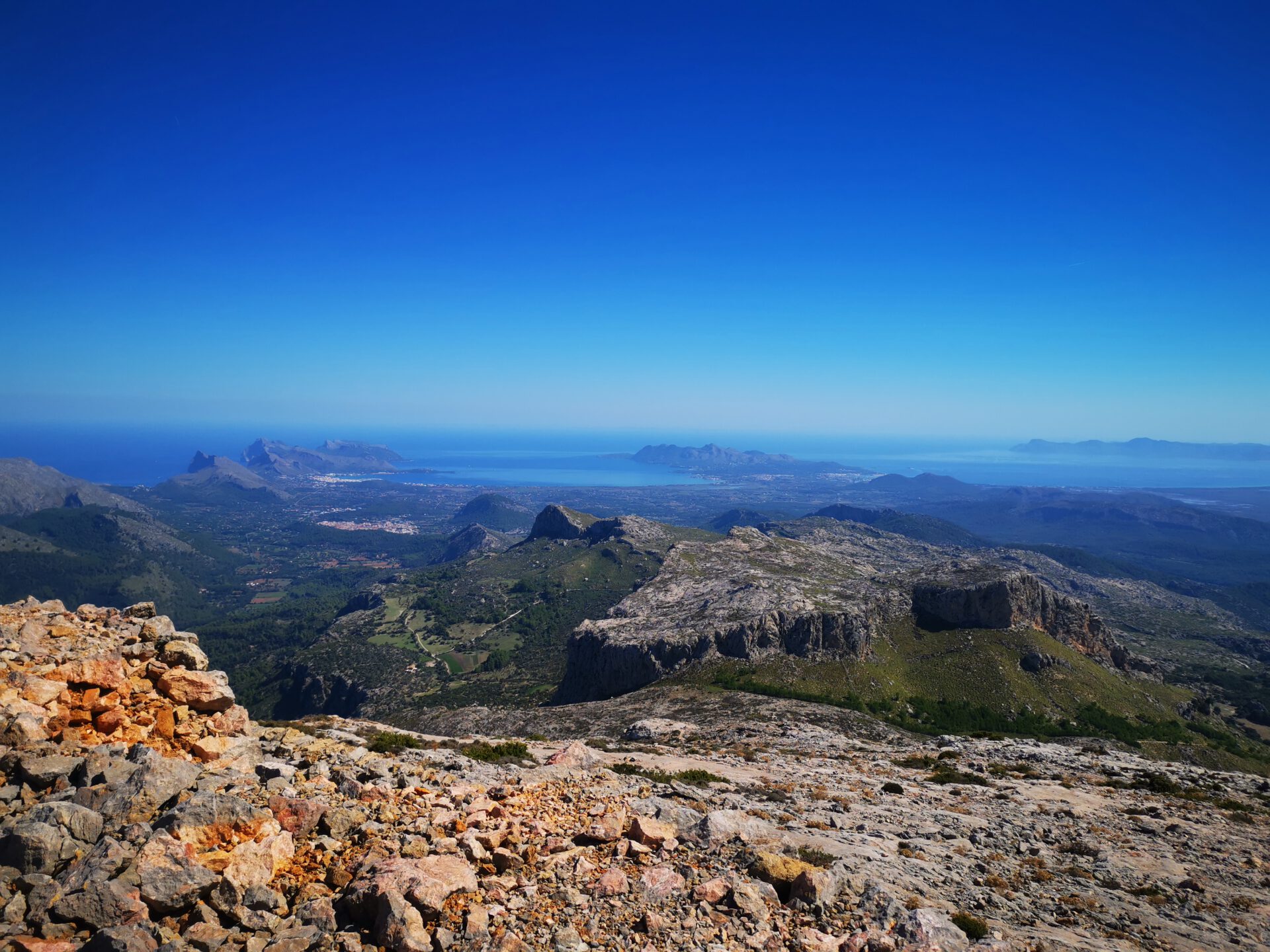
If you enjoy climbing, you’ll definitely get your money’s worth here. Plus, the view from the summit over the Bay of Pollença and the Bay of Alcudia is fantastic!
What to keep in mind
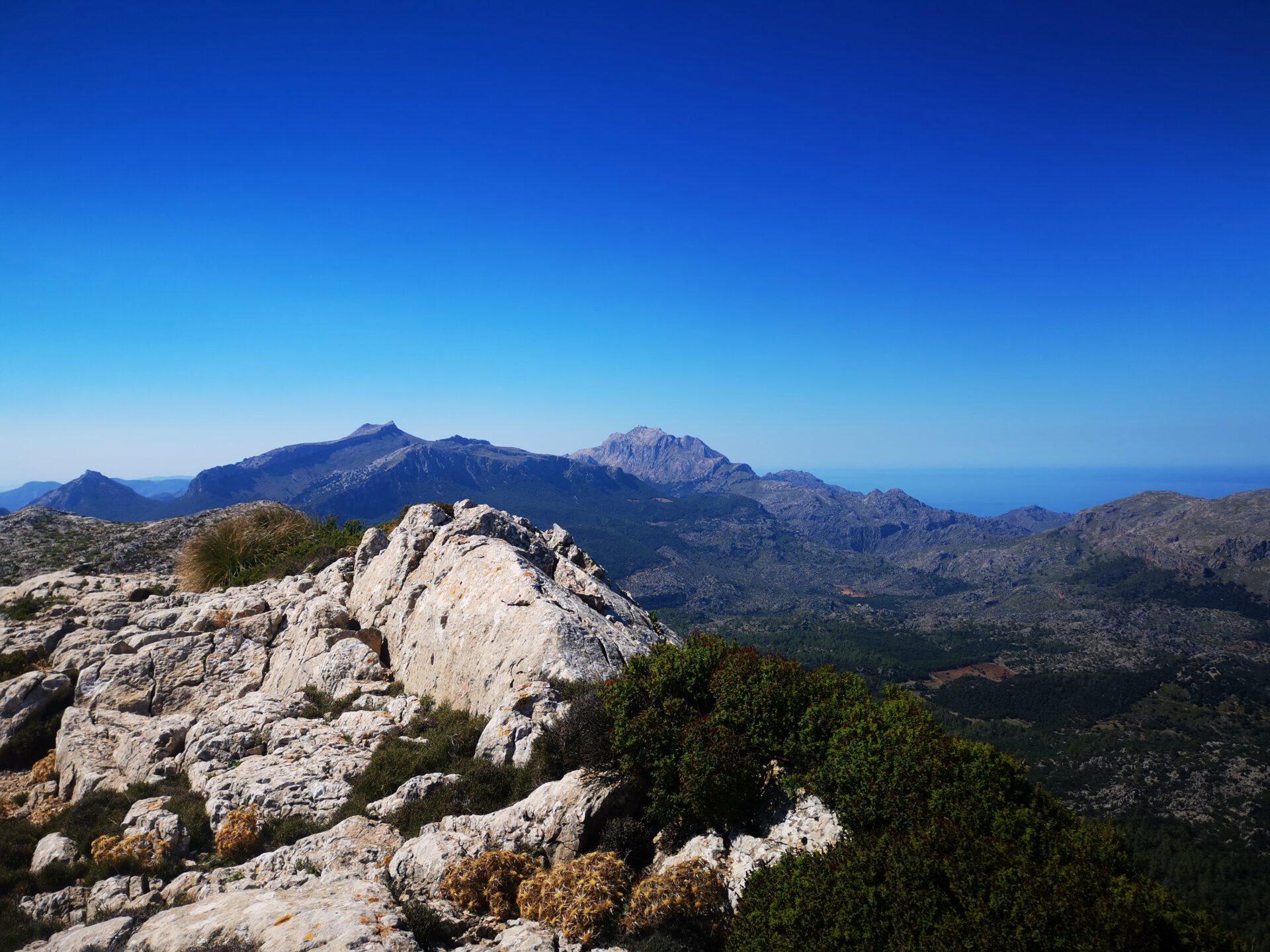
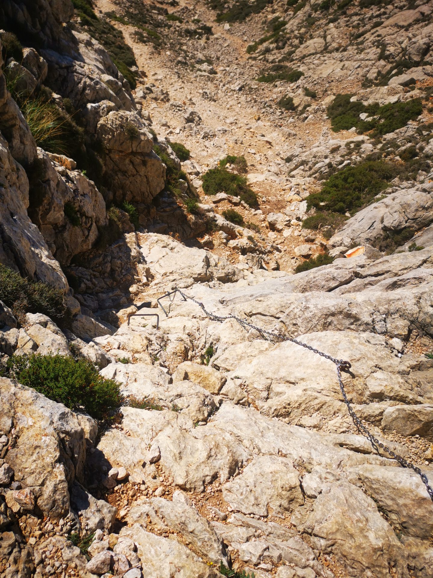
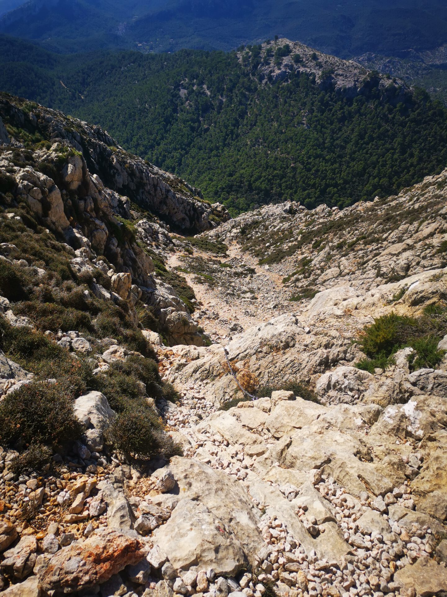
A short and challenging hike that is quite steep from the base of Tomir to the summit and requires some climbing skills and a minimum of a head for heights in at least one section.
starting point
A very small parking lot on the narrow access road to Menut i Binifaldo ( 39.830492, 2.896908). An alternative parking lot is available at the Lluc Monastery.
WANT MORE HIKES LIKE THIS?
Then take a look at our overview of all hikes on Mallorca! This route is part of our hikes in the Tramuntana mountains. Also, the Sa Rateta belongs to the highest summits of the Tramuntana.
This route was also featured in our Best of Mallorca guide to Tramuntana hikes.
FREQUENTLY ASKED QUESTIONS ABOUT THE Tomir hike
Very small parking area on the small access road to Menut i Binifaldó ( 39.830492, 2.896908). Alternative parking at Lluc Monastery.
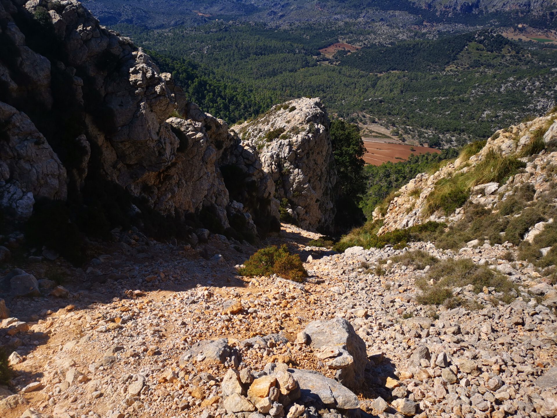
We have classified this tour as difficult, as at least one section involves overcoming a vertical height difference of around 8 metres. In addition, Tomir is one of the highest peaks in the Tramuntana, and near the summit you walk over the usual huge rocks, which definitely require sure-footedness.
The pure walking time is around 3 hours. To really enjoy the fantastic view, you should allow one extra hour overall.
Especially on the high peaks, there are no longer any paths and orientation is genuinely difficult. Thanks to the interactive 2D map with live location and illustrated route description, the tour is of course still manageable.
No. Like all our routes, you can access this route directly in your browser with GPS location — without an app or registration. Just make sure you bring enough battery life or a power bank for your smartphone.
No, from our point of view definitely not.
No. The entire tour runs through a lonely, unmanaged area. Take enough water and provisions with you — even in mild weather. If you start alternatively from Lluc Monastery, you can of course stop there for food or drink after the tour.
No — to the best of our knowledge, the tour can be done without a permit and without restrictions.
Anyone who enjoys climbing will definitely get their money’s worth here. In addition, the view from the summit over the Bay of Pollença and the Bay of Alcúdia is fantastic.
You should definitely bring a bit of willingness to scramble and a head for heights.
Weather on the Tomir hike
We provide a 24-hour forecast for planning your Tomir hike — including temperature, rain, sunshine, cloud cover, plus wind speed and wind direction, for both the start point and the destination.
Check the Weathermap FAQ for more details about the weather data!
Who’s behind Mallorca-Touren? Learn more here!
Have you done this hike and have additional notes? Send us a message!
Questions about the hikes, the maps, or what we offer? Find answers here!
We provide our hiking maps with a lot of care and genuine joy. If you truly like what we’re building here, we’d be very grateful for a donation!